
IMAGES TAKEN NEAR TO
Foxpark View, ALFRETON, DE55 5QJ
Introduction
This page details the photographs taken nearby to Foxpark View, DE55 5QJ by members of the Geograph project.
The Geograph project started in 2005 with the aim of publishing, organising and preserving representative images for every square kilometre of Great Britain, Ireland and the Isle of Man.

There are currently over 7.5m images from over14,400 individuals and you can help contribute to the project by visiting https://www.geograph.org.uk
Image Map
Images are licensed for reuse under creativecommons.org/licenses/by-sa/2.0
Notes
- Clicking on the map will re-center to the selected point.
- The higher the marker number, the further away the image location is from the centre of the postcode.
Image Listing (13 Images Found)
Images are licensed for reuse under creativecommons.org/licenses/by-sa/2.0
Image
Details
Distance

2

Tibshelf - Town End Junior School
On Alfreton Road. This school was designed by George Henry Widdows in 1912, completed in 1914 and extended in the 1960s. For more information, please see https://en.wikipedia.org/wiki/George_H._Widdows , http://www.heritagegateway.org.uk/Gateway/Results_Single.aspx?uid=MDR12826&resourceID=1023 and http://www.heritagegateway.org.uk/Gateway/Results_Single.aspx?uid=1496387&resourceID=2 .
Image: © Dave Bevis
Taken: 28 Jun 2015
0.08 miles
3

Public Bridleway
The bridleway links Image with Alfreton Road in Tibshelf Town End (which is just a few metres beyond the school building ahead).
More photographs of this public bridleway:-
North-eastern end
This photograph
Image
Image
Image
Image
South western end
Image: © Alan Walker
Taken: 21 Mar 2017
0.09 miles
4
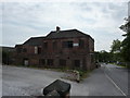
Former Scout Troop building
A very faded notice indicates the building was once used by the Tibshelf Baden Powell Scout Group.
Originally the Tibshelf and Newton Miners' Welfare, built by the Babbington Colliery Company in 1865. The building closed as a Welfare in 1985 and was used as the Scout HQ from 1987 to 1990. (thanks to Ivan Brentnall of Tibshelf Local History and Civic Society for this information)
Image: © Peter Barr
Taken: 5 Jun 2011
0.11 miles
5

Public Bridleway
The bridleway links Image (behind the viewpoint) with Tibshelf Town End (ahead).
The building seen across the field is Tibshelf Townend Junior School.
More photographs of this public bridleway:-
North-eastern end
Image
This photograph
Image
Image
Image
South western end
Image: © Alan Walker
Taken: 21 Mar 2017
0.14 miles
6

Tibshelf - Derelict Clubhouse on Newton Road (B6026)
Image: © Alan Heardman
Taken: 30 Jan 2009
0.14 miles
7
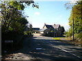
Tibshelf - View from Sunny Bank
Looking back towards the sharp bend entering Tibshelf.
Image: © Alan Heardman
Taken: 19 Oct 2007
0.15 miles
8
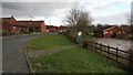
Shetland Road
The photograph shows the south-western end of Shetland Road and the pavilion for Tibshelf Recreation Ground.
Through the gate is a Image that follows the edge of the recreation ground and leads to a children's play area.
Some 350m ahead Shetland Road ends at a Image
A short distance behind the viewpoint is Newton Road (B6026).
Image: © Alan Walker
Taken: 4 Feb 2018
0.19 miles
9
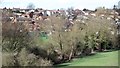
Looking toward Shetland Road from the Silverhill Trail
A children's play area on the corner of Shetland Road and Sunny Bank. The photograph also shows housing on the southern edge of Tibshelf.
Image: © Alan Walker
Taken: 21 Mar 2017
0.21 miles
10
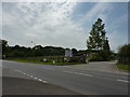
Equestrian and Pet Supplies
On the road from Tibshelf to Newton.
Image: © Peter Barr
Taken: 5 Jun 2011
0.22 miles