IMAGES TAKEN NEAR TO
West View, ALFRETON, DE55 5LX

Introduction

This page details the photographs taken nearby to West View, DE55 5LX by members of the Geograph project.

The Geograph project started in 2005 with the aim of publishing, organising and preserving representative images for every square kilometre of Great Britain, Ireland and the Isle of Man.

There are currently over 7.5m images from over14,400 individuals and you can help contribute to the project by visiting https://www.geograph.org.uk

Image Map


Images are licensed for reuse under creativecommons.org/licenses/by-sa/2.0
Notes
  • Clicking on the map will re-center to the selected point.
  • The higher the marker number, the further away the image location is from the centre of the postcode.

Image Listing (31 Images Found)

Images are licensed for reuse under creativecommons.org/licenses/by-sa/2.0
  • ...
Image
Details
Distance
1
Cut Mark 51 West View Tibshelf
Image: © Monica Stagg Taken: 16 Aug 2015
0.08 miles
2
Tibshelf; houses and footpath
Image: © Peter Barr Taken: 5 Jun 2011
0.09 miles
3
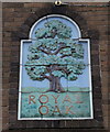
The Royal Oak, High Street, Tibshelf
The name has been changed to 'The Twisted Oak' for some reason, but the original name is still on the building, on an oddly placed central chimney-stack, which is where one would expect the front door to be.
Image: © Humphrey Bolton Taken: 2 Feb 2018
0.10 miles
4
The Royal Oak, Tibshelf
http://www.geograph.org.uk/photo/4334321 http://www.geograph.org.uk/photo/4334325
Image: © Ian S Taken: 31 Jan 2015
0.10 miles
5
Tibshelf - The Royal Oak
Image: © Dave Bevis Taken: 19 Oct 2014
0.10 miles
6
The Crown Hotel, Tibshelf
Image: © JThomas Taken: 29 Mar 2011
0.10 miles
7
Tibshelf - High Street (B6014)
The Royal Oak public house is on the left of picture.
Image: © Alan Heardman Taken: 19 Oct 2007
0.10 miles
8
The Royal Oak, Tibshelf
http://www.geograph.org.uk/photo/4334317 http://www.geograph.org.uk/photo/4334325
Image: © Ian S Taken: 31 Jan 2015
0.10 miles
9
Slap and Tickle
A closed down pub in Tibshelf, between a Methodist Church, a bus shelter and a piece of waste ground.
Image: © Peter Barr Taken: 5 Jun 2011
0.10 miles
10
Tibshelf - Methodist Church
This Wesleyan Methodist Chapel on High Street was erected in 1863 and was capable of accommodating 250 people. A Sunday School was added to the rear of the building (on Back Lane) in 1891. See the Derbyshire Historic Environment Record (http://www.heritagegateway.org.uk/Gateway/Results_Single.aspx?uid=MDR11769&resourceID=1023 ) for more details. The front entrance to the chapel is built in the Art Deco style, suggesting that this was a later (possibly 1930's) addition. This Wesleyan Chapel was one of three Methodist churches in Tibshelf. The others were: (a) A United Free Methodist Chapel on Addison Street. This was erected in 1884 and was a small plain structure, capable of seating 150. Now demolished. See http://www.heritagegateway.org.uk/Gateway/Results_Single.aspx?uid=MDR11771&resourceID=1023 for details. (b) A Primitive Methodist Chapel on Alfreton Road. This was built in 1878. Now demolished. See http://www.heritagegateway.org.uk/Gateway/Results_Single.aspx?uid=MDR11770&resourceID=1023 for details.
Image: © Dave Bevis Taken: 19 Oct 2014
0.10 miles
  • ...