
IMAGES TAKEN NEAR TO
The Paddock, ALFRETON, DE55 5HJ
Introduction
This page details the photographs taken nearby to The Paddock, DE55 5HJ by members of the Geograph project.
The Geograph project started in 2005 with the aim of publishing, organising and preserving representative images for every square kilometre of Great Britain, Ireland and the Isle of Man.

There are currently over 7.5m images from over14,400 individuals and you can help contribute to the project by visiting https://www.geograph.org.uk
Image Map
Images are licensed for reuse under creativecommons.org/licenses/by-sa/2.0
Notes
- Clicking on the map will re-center to the selected point.
- The higher the marker number, the further away the image location is from the centre of the postcode.
Image Listing (22 Images Found)
Images are licensed for reuse under creativecommons.org/licenses/by-sa/2.0
Image
Details
Distance
3
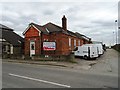
Cottage Inn
I believe that this was originally the Boys Brigade Hall and was used as an auxiliary hospital during the Great War. It was next to the Colliery Hospital and Miners Institute.
Image: © John M
Taken: 21 Apr 2017
0.05 miles
4
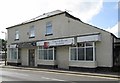
Blackwell - Miners Welfare & Social Club
On Primrose Hill. For an alternative view, please see Image
Image: © Dave Bevis
Taken: 9 Jul 2015
0.05 miles
5

Blackwell - School - former entrance steps
For further information on the school building, please see Image
Image: © Dave Bevis
Taken: 9 Jul 2015
0.06 miles
6

Blackwell - School - from SE
For further information on the school building, please see Image
Image: © Dave Bevis
Taken: 9 Jul 2015
0.06 miles
7

Blackwell - School - south side panorama
Blackwell Primary School was designed by the County Architect to Derbyshire County Council, George H. Widdows, was completed in 1915 and first appears on the OS map of 1917. The plan is a variant of the type described by Widdows as 'Plan No. 3' in a paper he presented to the Royal Sanitary Institute on 25 February 1910 (third type). It has a central hall with an entrance block on each side, but instead of paired classrooms set splayed at the ends, there are single classrooms in line with the hall and pairs of classrooms at right angles to the rear. An extension has been built to the rear of the east classroom wing. The exterior is relatively plain except for the two entrances, which are handsomely framed by moulded piers with stone and blue brick banding. The window joinery has been comprehensively replaced with UPVC. The school is built of red brick with stone dressings and a clay tile roof.
The current building is a replacement for an older school which is visible immediately to the east on the 1900 map, is marked as 'disused' on the 1917 map, and was demolished by 1938.
See http://www.pastscape.org.uk/hob.aspx?hob_id=1495837 and https://en.wikipedia.org/wiki/George_H._Widdows for more details.
For alternative views of the school please see Image and Image
Image: © Dave Bevis
Taken: 9 Jul 2015
0.06 miles
8
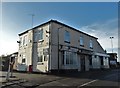
Blackwell - Miners Welfare & Social Club
As years pass, the memories of coal mining in this area begin to fade and the links that bound communities to coal are breaking.
Image: © Neil Theasby
Taken: 18 Dec 2017
0.07 miles
9
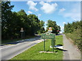
Welcome to Blackwell
The Parish Council of this former mining village have provided this sign, with the crossed pickaxe and cricket bat.
Image: © Peter Barr
Taken: 14 Aug 2013
0.10 miles
10
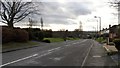
Alfreton Road
This south-westerly facing photograph is of Alfreton Road as it approaches Blackwell.
For a photograph taken some 280m ahead, click here:- Image
For a photograph of the road taken some 430m behind the viewpoint, click here:- Image
Image: © Alan Walker
Taken: 19 Jan 2018
0.13 miles