
IMAGES TAKEN NEAR TO
Brittain Drive, Codnor Gate Industrial Estate, RIPLEY, DE5 3RZ
Introduction
This page details the photographs taken nearby to Brittain Drive, Codnor Gate Industrial Estate, DE5 3RZ by members of the Geograph project.
The Geograph project started in 2005 with the aim of publishing, organising and preserving representative images for every square kilometre of Great Britain, Ireland and the Isle of Man.

There are currently over 7.5m images from over14,400 individuals and you can help contribute to the project by visiting https://www.geograph.org.uk
Image Map
Images are licensed for reuse under creativecommons.org/licenses/by-sa/2.0
Notes
- Clicking on the map will re-center to the selected point.
- The higher the marker number, the further away the image location is from the centre of the postcode.
Image Listing (22 Images Found)
Images are licensed for reuse under creativecommons.org/licenses/by-sa/2.0
Image
Details
Distance
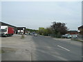
2
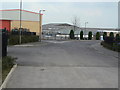
Top of Brittain Drive
Part of the Codnor Gate Industrial development. The road name is correctly spelt and is taken like all the road names on the estate from one of the local collieries.
Image: © Alan Murray-Rust
Taken: 14 Apr 2010
0.07 miles
3

Filigree Holdings Ltd offices and factory
Textiles manufacturer recently relocated to this business park
Image: © Graham Hogg
Taken: 9 May 2016
0.07 miles

5
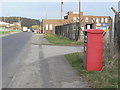
Codnor Gate Business Box Ref. DE5 786
A franked mail only box serving the Codnor Gate Industrial Estate.
Image: © Alan Murray-Rust
Taken: 14 Apr 2010
0.09 miles
6
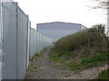
Footpath at Codnor Gate
This path follows the line of one of the branches of the former Butterley Company's railway system which served a number of collieries.
Image: © Alan Murray-Rust
Taken: 14 Apr 2010
0.09 miles
7
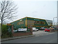
Builders Merchant, Brittain Drive, Codnor Gate
Image: © JThomas
Taken: 27 Apr 2010
0.09 miles
8

Footpath at the back of the industrial estate
The path follows the line of one of the branches of the former Butterley Company's railway network which served several pits in the neighbourhood.
Image: © Alan Murray-Rust
Taken: 14 Apr 2010
0.11 miles
9
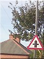
UK Crossroads Ahead Sign
UK Crossroads Ahead Sign on Nottingham Road, Ripley Derbyshire.
Image: © gary
Taken: 3 Oct 2016
0.13 miles
10

Industrial estate and harvested field
At Ripley, Derbyshire.
Image: © Peter Barr
Taken: 2 Sep 2010
0.14 miles