
IMAGES TAKEN NEAR TO
Argyll Road, RIPLEY, DE5 3LG
Introduction
This page details the photographs taken nearby to Argyll Road, DE5 3LG by members of the Geograph project.
The Geograph project started in 2005 with the aim of publishing, organising and preserving representative images for every square kilometre of Great Britain, Ireland and the Isle of Man.

There are currently over 7.5m images from over14,400 individuals and you can help contribute to the project by visiting https://www.geograph.org.uk
Image Map
Images are licensed for reuse under creativecommons.org/licenses/by-sa/2.0
Notes
- Clicking on the map will re-center to the selected point.
- The higher the marker number, the further away the image location is from the centre of the postcode.
Image Listing (42 Images Found)
Images are licensed for reuse under creativecommons.org/licenses/by-sa/2.0
Image
Details
Distance
1
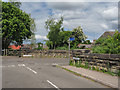
Junction of Outram Street and Alfred Street, Ripley
Junction of Outram Street (after Benjamin Outram) and Alfred Street in Ripley, Derbyshire. There are remains of a road bridge which crossed the former Little Eaton to Butterley railway line.
Image: © Martin Froggatt
Taken: 11 May 2020
0.06 miles
2
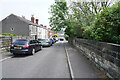
Outram Street
Outram Street is a narrow thoroughfare make even narrower by the row of parked cars.
Image: © Malcolm Neal
Taken: 3 Jun 2021
0.06 miles
4
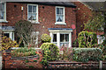
Birthplace of Sir Barnes Wallis, Ripley, Derbyshire
Transport Heritage Trust. Birthplace of the inventor, amongst many other things, the Bouncing Bomb, Sir Barnes Wallis.
Image: © Martin Froggatt
Taken: 15 Oct 2017
0.08 miles
5
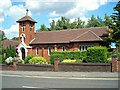
St. Joseph's Catholic Church
On Butterley Hill
Image: © Antony Dixon
Taken: 19 Jul 2013
0.08 miles
6
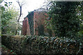
Pump house in Carr Wood
Marked on some old maps as belonging to Ripley Urban District Council, it is in fact a former mines drainage pumping station, one of the few remaining mining related structures in Ripley itself.
Image: © Alan Murray-Rust
Taken: 25 Oct 2011
0.09 miles
7
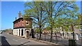
Buterley Hill meets Lowes Hill
To become Chapel Street behind this viewpoint
Image: © Chris Morgan
Taken: 9 May 2016
0.10 miles
8
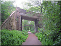
Path through Ripley
Heading north-west along the old Midland Railway extension route connecting Ripley with Butterley. The bridge carries the Lowes Hill road.
Image: © Trevor Rickard
Taken: 22 May 2011
0.11 miles
10
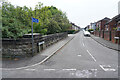
Alfred Street
Looking along Alfred Street, Ripley on a dull but warm day.
Image: © Malcolm Neal
Taken: 3 Jun 2021
0.11 miles