
IMAGES TAKEN NEAR TO
Hodder Close, MATLOCK, DE4 5NH
Introduction
This page details the photographs taken nearby to Hodder Close, DE4 5NH by members of the Geograph project.
The Geograph project started in 2005 with the aim of publishing, organising and preserving representative images for every square kilometre of Great Britain, Ireland and the Isle of Man.

There are currently over 7.5m images from over14,400 individuals and you can help contribute to the project by visiting https://www.geograph.org.uk
Image Map
Images are licensed for reuse under creativecommons.org/licenses/by-sa/2.0
Notes
- Clicking on the map will re-center to the selected point.
- The higher the marker number, the further away the image location is from the centre of the postcode.
Image Listing (198 Images Found)
Images are licensed for reuse under creativecommons.org/licenses/by-sa/2.0
Image
Details
Distance
1

Junction of Dowie Way and Hodder Close, Crich
Image: © David Beresford
Taken: 18 Feb 2013
0.02 miles
2

Footpath at the back of Wheatsheaf House
An attractive village-urban footpath, which has been modernised as a result of new housing development to the right of the picture. Of interest are the passageway through the building at the back - Wheatsheaf House, which may be the former Wheatsheaf pub - and the footbridge at the bottom of the dip. This does not cross, as might be suspected, a watercourse, but rather a narrow gauge railway which ran into the old Church Quarry. A view from this bridge can be seen here: Image
Image: © Alan Murray-Rust
Taken: 4 Mar 2009
0.02 miles
3

Hodder Close, Crich
Photo from junction with Dowie Way.
Image: © David Beresford
Taken: 18 Feb 2013
0.02 miles
4
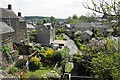
Back road off Wheatsheaf Lane
This illustrates some of the gradients in Crich village.
Image: © Bill Boaden
Taken: 7 May 2022
0.02 miles
5

Tunnel into Church Quarry
This was the old railway access into the quarry. It was a branch off the main line of the railway up to the much larger Crich (Cliff) Quarry. Church Quarry closed a relatively short time after the opening up of Cliff Quarry in the late 1840s, so this tunnel has been disused for some 150 years. It now forms convenient garden storage.
This view is from the footpath which crosses the alignment on a bridge at this point. Image At the top of the picture the wall is the edge of Cromford Road.
Image: © Alan Murray-Rust
Taken: 4 Mar 2009
0.02 miles
6
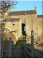
Through Wheatsheaf House
It's unusual for a public footpath to run right through a house like this, but I believe this to have been former the Wheatsheaf Inn. In the foreground is a footbridge across the alignment of the narrow gauge railway into the old Church Quarry, which was a branch off the railway to Crich Quarry. There is an additional connection in as much as George Stephenson who engineered the railway (he was a director of the quarry company), used to stay at the Wheatsheaf when visiting Crich.
Image: © Alan Murray-Rust
Taken: 4 Mar 2009
0.03 miles

8

Hodder Close
Modern housing development below Crich Church. Planning regulations have required these houses to use local stone to retain the visual qualities of the area.
The road takes its name from one of the steam locomotives which ran on the railway up to Crich Quarry. The line of the railway is still visible to the rear of the houses on the right. There aren't many roads which are named after locomotives at all, but mainly they will be famous main line ones. I wonder if there are any others which are named after locomotives as mundane as this pair of narrow-gauge industrial ones?
Hodder itself was so named by the quarry company because it had previously worked as a contractor's locomotive on the Stocks Reservoir project in the Hodder Valley above Slaidburn.
Image: © Alan Murray-Rust
Taken: 4 Mar 2009
0.03 miles

10

Dowie Way, Crich
Dowie Way leads off Cromford Road near the parish church.
Image: © David Beresford
Taken: 16 Feb 2013
0.04 miles