
IMAGES TAKEN NEAR TO
Highfield Drive, BAKEWELL, DE45 1GW
Introduction
This page details the photographs taken nearby to Highfield Drive, DE45 1GW by members of the Geograph project.
The Geograph project started in 2005 with the aim of publishing, organising and preserving representative images for every square kilometre of Great Britain, Ireland and the Isle of Man.

There are currently over 7.5m images from over14,400 individuals and you can help contribute to the project by visiting https://www.geograph.org.uk
Image Map
Images are licensed for reuse under creativecommons.org/licenses/by-sa/2.0
Notes
- Clicking on the map will re-center to the selected point.
- The higher the marker number, the further away the image location is from the centre of the postcode.
Image Listing (89 Images Found)
Images are licensed for reuse under creativecommons.org/licenses/by-sa/2.0
Image
Details
Distance
1

Goalposts and thorny hedge
Lady Manners' School playing fields
Image: © Peter Barr
Taken: 21 Dec 2008
0.04 miles
2

Rural Council Housing - Moorhall
Probably post war housing.
Image: © John M
Taken: 2 May 2011
0.06 miles
3
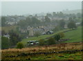
Western edge of Bakewell
A misty view of the edge of town on the hillside.
Image: © Andrew Hill
Taken: 20 Sep 2011
0.07 miles

5

Retaining wall, Monyash Road, Bakewell
Once a building, with door and two windows
Image: © Peter Barr
Taken: 5 Sep 2009
0.08 miles
6

Rural Council Housing - Highfield Drive
Into the 1960s and 1970s. The properties are managed by Dales Housing.
Image: © John M
Taken: 2 May 2011
0.08 miles
7

Houses, Moorhall, Bakewell
Set on a hillside above the town centre.
Image: © Andrew Hill
Taken: 19 Sep 2011
0.08 miles
8

Cut Mark Pickford Villas Monyash Rd Bakewell
Image: © Monica Stagg
Taken: 13 Apr 2015
0.10 miles

10

Looking up Monyash Road, Bakewell
View from the Tower of All Saints Church.The road can just be seen at the bottom left corner of the picture.
Image: © Peter Barr
Taken: 6 Jun 2014
0.13 miles