IMAGES TAKEN NEAR TO
Brassington, MATLOCK, DE4 4DA
Introduction
This page details the photographs taken nearby to DE4 4DA by members of the Geograph project.
The Geograph project started in 2005 with the aim of publishing, organising and preserving representative images for every square kilometre of Great Britain, Ireland and the Isle of Man.

There are currently over 7.5m images from over14,400 individuals and you can help contribute to the project by visiting https://www.geograph.org.uk
Image Map
Images are licensed for reuse under creativecommons.org/licenses/by-sa/2.0
Notes
- Clicking on the map will re-center to the selected point.
- The higher the marker number, the further away the image location is from the centre of the postcode.
Image Listing (5 Images Found)
Images are licensed for reuse under creativecommons.org/licenses/by-sa/2.0
Image
Details
Distance
2
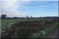
A view over frozen fields
With some frost still on the twigs and in the grass even after the sun has been out, it shows how cold it has been.
Image: © Malcolm Neal
Taken: 13 Dec 2022
0.08 miles
3
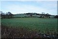
Frozen fields
Even on this roughly south facing field there is still frost on the grass in mid afternoon.
Image: © Malcolm Neal
Taken: 13 Dec 2022
0.16 miles
5
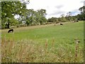
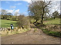
Bisected field near Brassington
Clearly previously been fenced into two parts but cows grazing freely on both sides. One half seems to have been mown very short.
Image: © Chris Morgan
Taken: 17 Oct 2012
0.21 miles