
IMAGES TAKEN NEAR TO
Derby Road/Oat Hill, Derby Road, MATLOCK, DE4 4AQ
Introduction
This page details the photographs taken nearby to Derby Road/Oat Hill, Derby Road, DE4 4AQ by members of the Geograph project.
The Geograph project started in 2005 with the aim of publishing, organising and preserving representative images for every square kilometre of Great Britain, Ireland and the Isle of Man.

There are currently over 7.5m images from over14,400 individuals and you can help contribute to the project by visiting https://www.geograph.org.uk
Image Map
Images are licensed for reuse under creativecommons.org/licenses/by-sa/2.0
Notes
- Clicking on the map will re-center to the selected point.
- The higher the marker number, the further away the image location is from the centre of the postcode.
Image Listing (39 Images Found)
Images are licensed for reuse under creativecommons.org/licenses/by-sa/2.0
Image
Details
Distance
1
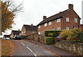
Oat Hill, Wirksworth, Derbys
Some community services premises set amongst a row of ordinary houses on a quiet road parallel to the main Derby-Wirksworth Road (the B5023). The nearest blue door leads into "Askew House" with premises that are used by Victim Support Team members and Community Mental Health Team staff, whereas the door furthest away provides access for police officers into a Community Police Office. These premises face the B5023, a road that runs at a lower level than Oat Hill.
Image: © David Hallam-Jones
Taken: 18 Oct 2014
0.01 miles
2
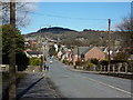
Derby Road, B5023, Wirksworth
Looking north towards the town centre.
Image: © Peter Barr
Taken: 13 Mar 2010
0.02 miles
3
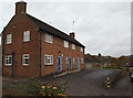
Oat Hill, Wirksworth, Derbys
Community services premises on a quiet road parallel to the main Derby-Wirksworth Road (the B5023). The nearest door provides access for police officers into a Community Police Office, whereas the second door leads into "Askew House" that provides premises for Victim Support team members and Community Mental Health Team staff.
Image: © David Hallam-Jones
Taken: 18 Oct 2014
0.03 miles
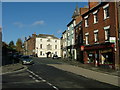
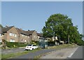
6
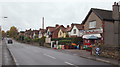
Derby Road, Wirksworth, Derbys
A view along the B5023 towards the Oat Hill and Miller's Green areas with the Warmbrook stretch of the Wirksworth-Derby road and the town centre behind the photographer.
Image: © David Hallam-Jones
Taken: 18 Oct 2014
0.10 miles
7
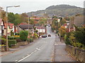
Wirksworth, Derbys
With the King's Field district behind the photographer, this is a view from the summit of the Oat Hill stretch of the B5023 road (Derby Road) looking towards the Warmbrook area of the town.
Image: © David Hallam-Jones
Taken: 18 Oct 2014
0.11 miles
8

Warmbrook, Wirksworth, Derbys
This grey car is about to tackle the gradual climb into the town centre on the B5023 (Derby-Wirksworth Road), known locally as Derby Road. The vehicle on the right is turning into Water Lane.
Image: © David Hallam-Jones
Taken: 18 Oct 2014
0.14 miles
9
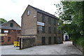
Former mill building at Willowbath Mill
Now occupied by small engineering firms the mill was set up to manufacture tape.
Image: © John M
Taken: 25 Jun 2013
0.16 miles
10

Warmbrook View
The view down the Wirksworth street.
Image: © Gordon Griffiths
Taken: 22 Sep 2013
0.16 miles