
IMAGES TAKEN NEAR TO
Sheriff Drive, MATLOCK, DE4 3JT
Introduction
This page details the photographs taken nearby to Sheriff Drive, DE4 3JT by members of the Geograph project.
The Geograph project started in 2005 with the aim of publishing, organising and preserving representative images for every square kilometre of Great Britain, Ireland and the Isle of Man.

There are currently over 7.5m images from over14,400 individuals and you can help contribute to the project by visiting https://www.geograph.org.uk
Image Map
Images are licensed for reuse under creativecommons.org/licenses/by-sa/2.0
Notes
- Clicking on the map will re-center to the selected point.
- The higher the marker number, the further away the image location is from the centre of the postcode.
Image Listing (10 Images Found)
Images are licensed for reuse under creativecommons.org/licenses/by-sa/2.0
Image
Details
Distance
4
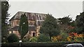
All Saints Parish Church, Matlock Bank
Church website supplies background at; http://www.allsaintsmatlock.org.uk/index.php/about-the-church
Image: © Chris Morgan
Taken: 20 Oct 2014
0.20 miles
5
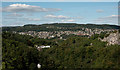
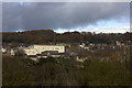
Matlock, viewed from The Heights of Abraham
All Saints Parish Church is in the centre of this image. To the right are the County Council Offices. The white houses just below centre are on St John's Road.
Image: © Roger A Smith
Taken: 17 Sep 2019
0.21 miles
6

Old Milestone by the A6, Bakewell Road
Carved stone post by the A6, in parish of MATLOCK TOWN (DERBYSHIRE DALES District), Bakewell Road; by Twigg Engineering Works (near No. 133), on grass verge between tarmac path and road, on South side of road. Matlock triangle, erected by the Wirksworth Moor to Longstone turnpike trust in the 19th century.
Inscription reads:-
: TO / BAKEWELL / (8)M / BUXTON / 20 M. / - : : LONDON / 144 / Miles : : TO / MATLOCK / 2 M. / DERBY / 18M. / - :
Bench mark and rivet on top left.
Grade II Listed. List Entry Number:1247834
https://historicengland.org.uk/listing/the-list/list-entry/1247834
Milestone Society National ID: DE_LM144.
Image: © A Rosevear & J Higgins
Taken: 1 May 2002
0.22 miles
7
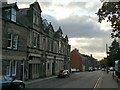
Smedley Street
Named after John Smedley, who put Matlock on the map as a hydropathic spa, it is the principal street across the slope of Matlock Bank.
Image: © Alan Murray-Rust
Taken: 4 Oct 2009
0.23 miles
8
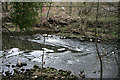
Remains of a weir?
The flow pattern and signs of masonry on both banks probably indicates the site of a weir.
Image: © David Lally
Taken: 26 Mar 2011
0.24 miles
9

Bypass roundabout
New roundabout at the Western end of the recently opened Matlock bypass. New "affordable housing" is being built along Bakewell Road.
Image: © Gerald England
Taken: 14 May 2010
0.24 miles
10
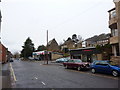
Smedley Street, Matlock
Car dealership, church and not much traffic
Image: © Peter Barr
Taken: 29 Dec 2009
0.25 miles