
IMAGES TAKEN NEAR TO
Hopewell Road, MATLOCK, DE4 3JN
Introduction
This page details the photographs taken nearby to Hopewell Road, DE4 3JN by members of the Geograph project.
The Geograph project started in 2005 with the aim of publishing, organising and preserving representative images for every square kilometre of Great Britain, Ireland and the Isle of Man.

There are currently over 7.5m images from over14,400 individuals and you can help contribute to the project by visiting https://www.geograph.org.uk
Image Map
Images are licensed for reuse under creativecommons.org/licenses/by-sa/2.0
Notes
- Clicking on the map will re-center to the selected point.
- The higher the marker number, the further away the image location is from the centre of the postcode.
Image Listing (53 Images Found)
Images are licensed for reuse under creativecommons.org/licenses/by-sa/2.0
Image
Details
Distance
1

Smedley Street, Matlock
Former industrial buildings now form part of an imposing office complex with bridges over the street.
Image: © Andrew Hill
Taken: 13 Jun 2012
0.04 miles
2
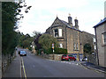
Wellington Street, Matlock Bank
This rises diagonally across the steep slope of Matlock Bank.
Image: © Alan Murray-Rust
Taken: 4 Oct 2009
0.04 miles
3

Bridge of Local Government
An interconnecting bridge between two parts of Council Offices, Matlock
Image: © Peter Barr
Taken: 29 Dec 2009
0.04 miles
4

Matlock Bank - Smedley Street
County Offices entrance is on the left hand side of the road, near to the link bridge.
Image: © Alan Heardman
Taken: 14 Oct 2007
0.05 miles
5
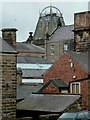
Buildings in Matlock
Looking across the end of Hopewell Road to buildings on Smedley Street.
Image: © Andrew Hill
Taken: 13 Jun 2012
0.05 miles

7

Smedley's Hydro, the tower
Built as part of the 1885 extension to the Hydropathic (now Derbyshire County Council offices).
Image: © Alan Murray-Rust
Taken: 4 Oct 2009
0.06 miles
8

Looking down Rockside Steps
The upper section isn't actually stepped, though still steep enough. The slope of the Matlock Bank hillside provides near-aerial views of the town below.
Image: © Alan Murray-Rust
Taken: 4 Oct 2009
0.06 miles
9

Matlock - County Offices rooftop from Cobden Road jitty
Riber Castle can be seen in the background. On the day that this photograph was taken, members of the Matlock Civic Society were painting the metalwork on the top of County Offices tower with gold paint.
Image: © Dave Bevis
Taken: 23 Apr 2004
0.06 miles
10

Matlock Bank, Rutland Street
This is the upper extension of Bank Road, which the car is just entering, and was the route of the cable tramway which operated until 1927.
Image: © Alan Murray-Rust
Taken: 4 Oct 2009
0.06 miles