
IMAGES TAKEN NEAR TO
Woolley Road, MATLOCK, DE4 3HU
Introduction
This page details the photographs taken nearby to Woolley Road, DE4 3HU by members of the Geograph project.
The Geograph project started in 2005 with the aim of publishing, organising and preserving representative images for every square kilometre of Great Britain, Ireland and the Isle of Man.

There are currently over 7.5m images from over14,400 individuals and you can help contribute to the project by visiting https://www.geograph.org.uk
Image Map
Images are licensed for reuse under creativecommons.org/licenses/by-sa/2.0
Notes
- Clicking on the map will re-center to the selected point.
- The higher the marker number, the further away the image location is from the centre of the postcode.
Image Listing (29 Images Found)
Images are licensed for reuse under creativecommons.org/licenses/by-sa/2.0
Image
Details
Distance
1
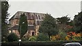
All Saints Parish Church, Matlock Bank
Church website supplies background at; http://www.allsaintsmatlock.org.uk/index.php/about-the-church
Image: © Chris Morgan
Taken: 20 Oct 2014
0.09 miles
2
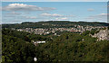
Matlock, viewed from The Heights of Abraham
All Saints Parish Church is in the centre of this image. To the right are the County Council Offices. The white houses just below centre are on St John's Road.
Image: © Roger A Smith
Taken: 17 Sep 2019
0.10 miles
4
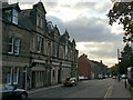
Smedley Street
Named after John Smedley, who put Matlock on the map as a hydropathic spa, it is the principal street across the slope of Matlock Bank.
Image: © Alan Murray-Rust
Taken: 4 Oct 2009
0.11 miles
5
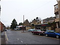
Smedley Street, Matlock
Car dealership, church and not much traffic
Image: © Peter Barr
Taken: 29 Dec 2009
0.12 miles
6
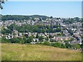
Matlock Bank
Seen from the Limestone Way long distance footpath. The large building in roughly the centre of the image is County Hall.
Image: © Michael Dibb
Taken: 28 Jun 2018
0.13 miles
7
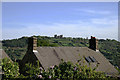
Matlock rooftop
The two chimneys on this house on Smith Road, Matlock reflect the pattern of the towers of Riber Castle on the hill beyond.
Image: © David Lally
Taken: 1 May 2011
0.16 miles
8
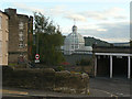
Smedley's Hydro, the conservatory
The stone building to the left is part of the original 1867 construction.
Image: © Alan Murray-Rust
Taken: 4 Oct 2009
0.17 miles
9

Matlock from High Tor
The large building in the centre of the photograph is Matlock Bank, formerly a hydrotherapy centre and now the main offices of Derbyshire County Council.
Image: © Graham Hogg
Taken: 4 Oct 2011
0.17 miles
10
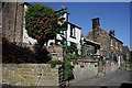
The Thorn Tree
Greene King pub on Jackson Road Matlock. High above the town centre. The beer terrace at the front has a spectacular view over Matlock down the Derwent valley to The Heights of Abraham, High Tor and beyond. Cosy interior and well-kept ales (at least the Timothy Taylor Landlord was at the time of our visit).
Listed in the 2011 Good Beer Guide.
Image: © David Lally
Taken: 1 May 2011
0.18 miles