
IMAGES TAKEN NEAR TO
Upper Greenhill Gardens, Rutland Street, MATLOCK, DE4 3GT
Introduction
This page details the photographs taken nearby to Upper Greenhill Gardens, Rutland Street, DE4 3GT by members of the Geograph project.
The Geograph project started in 2005 with the aim of publishing, organising and preserving representative images for every square kilometre of Great Britain, Ireland and the Isle of Man.

There are currently over 7.5m images from over14,400 individuals and you can help contribute to the project by visiting https://www.geograph.org.uk
Image Map
Images are licensed for reuse under creativecommons.org/licenses/by-sa/2.0
Notes
- Clicking on the map will re-center to the selected point.
- The higher the marker number, the further away the image location is from the centre of the postcode.
Image Listing (54 Images Found)
Images are licensed for reuse under creativecommons.org/licenses/by-sa/2.0
Image
Details
Distance
1
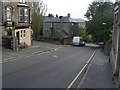
Matlock Bank, Rutland Street
This is the upper extension of Bank Road, and was the route of the cable tramway which operated until 1927.
Image: © Alan Murray-Rust
Taken: 4 Oct 2009
0.04 miles
2
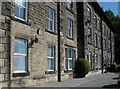
Matlock - Rutland Court
Formerly Matlock House Hydro. Now flats.
Image: © Dave Bevis
Taken: 28 Dec 2010
0.04 miles
3

Matlock Bank, Rutland Street
This is the upper extension of Bank Road, which the car is just entering, and was the route of the cable tramway which operated until 1927.
Image: © Alan Murray-Rust
Taken: 4 Oct 2009
0.07 miles
4
Buildings in Matlock
Looking across the end of Hopewell Road to buildings on Smedley Street.
Image: © Andrew Hill
Taken: 13 Jun 2012
0.08 miles
5
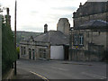
Old tramway depot
This extensive building housed the modest fleet of three cable cars which operated a route of just over half-a-mile up Matlock Bank, with a steepest gradient of I in 5½. The cars operated by gripping a continuous cable, in the same manner as the famous San Francisco cable cars. They ran from 1893 to 1927. As well as the trams, the buildings housed a workshop, a steam winding engine, boiler house and offices. The odd structure rising from the roof is the base of the chimney for the boilers.
Image: © Alan Murray-Rust
Taken: 4 Oct 2009
0.08 miles
6
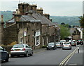
Wellington Street, Matlock
A view down the road which slants across the hillside to the top of the steep Matlock Bank road.
Image: © Andrew Hill
Taken: 13 Jun 2012
0.08 miles
7
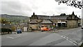
Top end of Rutland Street, Matlock
In earlier days the Matlock Spa Hotel was just below this point, it's grand central tower still visible in this picture. The building is now Derbyshire County Council offices.
The garage was originally the tram barn for the Matlock Cable Tramway cable trams from the station and the centre of town at the bottom of the hill up to the hotel. More details of that at; http://en.wikipedia.org/wiki/Matlock_Cable_Tramway
Image: © Chris Morgan
Taken: 20 Oct 2014
0.08 miles
9
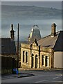
View to the tower of Smedley's Hydro
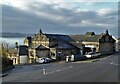
Seen from Wellington Street. Smedley's Hydro was a hydropathic facility developed in the second half of the nineteenth century. In the 1950's the old building was taken over by Derbyshire County Council, becoming the organisations administrative hub. The mist in the valley was related to a high pressure weather system settling over the north of England. The illuminated building on the corner was part of the old Matlock tram depot.
Image: © Neil Theasby
Taken: 16 Dec 2021
0.08 miles
10
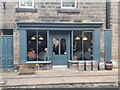
The Newsroom micropub
A micropub in an old newsagents shop.
Image: © Ian Calderwood
Taken: 29 Dec 2023
0.08 miles