
IMAGES TAKEN NEAR TO
Chesterfield Road, MATLOCK, DE4 2EY
Introduction
This page details the photographs taken nearby to Chesterfield Road, DE4 2EY by members of the Geograph project.
The Geograph project started in 2005 with the aim of publishing, organising and preserving representative images for every square kilometre of Great Britain, Ireland and the Isle of Man.

There are currently over 7.5m images from over14,400 individuals and you can help contribute to the project by visiting https://www.geograph.org.uk
Image Map
Images are licensed for reuse under creativecommons.org/licenses/by-sa/2.0
Notes
- Clicking on the map will re-center to the selected point.
- The higher the marker number, the further away the image location is from the centre of the postcode.
Image Listing (48 Images Found)
Images are licensed for reuse under creativecommons.org/licenses/by-sa/2.0
Image
Details
Distance
1
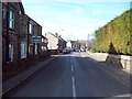
Chesterfield Road in Darley Dale
Darley Dale Post Office is visible in the centre of this picture which was taken on a bright Friday morning in mid March.
Image: © Jonathan Clitheroe
Taken: 11 Mar 2011
0.01 miles
3
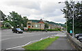
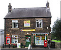
Road junction in Darley Dale
The road left is Chesterfield Road which leaves the A6 here. The building opposite is a cafe. It was formerly a pharmacy but I am sure it was previously a retail bank.
Image: © Bill Boaden
Taken: 7 Aug 2021
0.05 miles
4
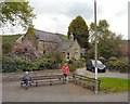
Underhall, Darley Day
Underhall on Chesterfield Road offers sheltered accommodation for the elderly.
Image: © Gerald England
Taken: 14 May 2010
0.06 miles
7

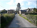
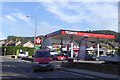
Old Milepost by the A6, Dale Road North, Darley Dale
Cast iron plate by the A6, in parish of DARLEY DALE (DERBYSHIRE DALES District), Darley Road; North of junction with Station Road (junction with Stone Edge Rd. opposite Whitworth Arms), in tarmac path in front of low stone wall, on North East side of road. Darley iron plate, erected by the Wirksworth Moor to Longstone turnpike trust in the 19th century. An earlier photograph can be found here https://www.geograph.org.uk/photo/5623828.
Inscription reads:-
: BAKEWELL / 6. M . : : TO / LONDON . / 146 . MILES . : : MATLOCK / 4 . M . :
Grade II Listed. List Entry Number:1247896 https://historicengland.org.uk/listing/the-list/list-entry/1247896
Milestone Society National ID: DE_LM146.
Image: © Nigel Upton
Taken: 6 Nov 2022
0.09 miles
8

Old Milepost by the A6, Dale Road North, Darley Dale
Cast iron plate by the A6, in parish of DARLEY DALE (DERBYSHIRE DALES District), Darley Road; North of junction with Station Road (junction with Stone Edge Rd. opposite Whitworth Arms), in tarmac path in front of low stone wall, on North East side of road. Darley iron plate, erected by the Wirksworth Moor to Longstone turnpike trust in the 19th century.
Inscription reads:-
: BAKEWELL / 6. M . : : TO / LONDON . / 146 . MILES . : : MATLOCK / 4 . M . :
Grade II Listed. List Entry Number:1247896
https://historicengland.org.uk/listing/the-list/list-entry/1247896
Milestone Society National ID: DE_LM146.
Image: © J Higgins
Taken: 1 May 2002
0.09 miles
9
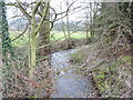
Warney Brook
A small tributary of the River Derwent; here flowing under a bridge,between an allotment and a garden centre, then under A6
Image: © Peter Barr
Taken: 29 Dec 2009
0.10 miles
10
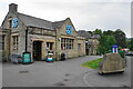
Co-op store in Darley Dale
I think this building used to be the RBS bank, being the last retail bank to close in the town.
Image: © Bill Boaden
Taken: 7 Aug 2021
0.10 miles