
IMAGES TAKEN NEAR TO
Napier Close, DERBY, DE3 9JL
Introduction
This page details the photographs taken nearby to Napier Close, DE3 9JL by members of the Geograph project.
The Geograph project started in 2005 with the aim of publishing, organising and preserving representative images for every square kilometre of Great Britain, Ireland and the Isle of Man.

There are currently over 7.5m images from over14,400 individuals and you can help contribute to the project by visiting https://www.geograph.org.uk
Image Map
Images are licensed for reuse under creativecommons.org/licenses/by-sa/2.0
Notes
- Clicking on the map will re-center to the selected point.
- The higher the marker number, the further away the image location is from the centre of the postcode.
Image Listing (80 Images Found)
Images are licensed for reuse under creativecommons.org/licenses/by-sa/2.0
Image
Details
Distance
1
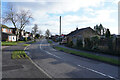
Onslow Road
With bungalows to the right and two storey semi-detached houses to the left Onslow Road curves round to eventually meet Brisbane Road.
Image: © Malcolm Neal
Taken: 21 Jan 2021
0.02 miles
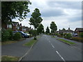
3

The footpath connecting Buxton Drive and Mill Lane
The footpath runs behind the houses that are on Rangemore Close top the south and various streets to the north.
Image: © Malcolm Neal
Taken: 16 Jan 2021
0.04 miles
4
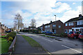
Onslow Road
At the moment Onslow Road marks the edge of the houses of Mickleover, but it is soon to have a new housing development built to the north.
Image: © Malcolm Neal
Taken: 21 Jan 2021
0.05 miles
5
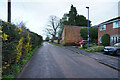
Mill Lane
Mill Lane has one very much older large house and a few typical semi-detached houses. The road turns into a footpath which then connects with Buxton Drive.
Image: © Malcolm Neal
Taken: 16 Jan 2021
0.05 miles
6

Mill Lane
This is the large older house on Mill Lane. I presume the other houses (see Image for some of these houses) are built on land that used to belong to this house.
Image: © Malcolm Neal
Taken: 16 Jan 2021
0.07 miles
7

Onslow Road
The start of Onslow Road on a bright sunny morning. The sky has become almost cloudless which was not forecast.
Image: © Malcolm Neal
Taken: 12 Jan 2021
0.08 miles
8
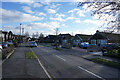
Onslow Road
With a blue sky and fluffy clouds over Onslow Road this is a very much more pleasant day than the previous days when it was far wetter.
Image: © Malcolm Neal
Taken: 21 Jan 2021
0.09 miles

10

Development off Station Road
On the outskirts of Mickleover this field has recently been surrounded by security fencing in preparation for a new housing development.
Image: © Malcolm Neal
Taken: 9 Jan 2021
0.09 miles