
IMAGES TAKEN NEAR TO
Swan Hill, DERBY, DE3 0UW
Introduction
This page details the photographs taken nearby to Swan Hill, DE3 0UW by members of the Geograph project.
The Geograph project started in 2005 with the aim of publishing, organising and preserving representative images for every square kilometre of Great Britain, Ireland and the Isle of Man.

There are currently over 7.5m images from over14,400 individuals and you can help contribute to the project by visiting https://www.geograph.org.uk
Image Map
Images are licensed for reuse under creativecommons.org/licenses/by-sa/2.0
Notes
- Clicking on the map will re-center to the selected point.
- The higher the marker number, the further away the image location is from the centre of the postcode.
Image Listing (30 Images Found)
Images are licensed for reuse under creativecommons.org/licenses/by-sa/2.0
Image
Details
Distance
1
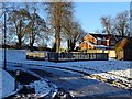
Children's play park
On an icy cold day with no children in sight.
Image: © Ian Calderwood
Taken: 11 Dec 2017
0.01 miles
2
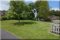
An open space amongst the houses
The housing estate has been laid out with several open spaces of which this is one.
Image: © Malcolm Neal
Taken: 5 May 2020
0.02 miles
3
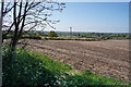
The footpath to Burnaston
From the edge of Mickleover the housing estate becomes fields, rather dry and dusty as we have had no rain for nearly four weeks. The footpath runs along the grassy field boundary.
Image: © Malcolm Neal
Taken: 25 Apr 2020
0.05 miles
4

Houses on Sandpiper Lane
The grey featureless sky does not help the image of these fairly new houses on Sandpiper Lane.
Image: © Malcolm Neal
Taken: 29 Jan 2021
0.07 miles
5
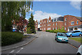
Sandpiper Lane
The junction of Sandpiper Lane and Merlin Way both relatively new developments in the last twenty or so years.
Image: © Malcolm Neal
Taken: 5 May 2020
0.07 miles
6
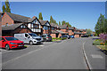
Lark Hill
I am sure in normal times there would be many more people about but the lockdown has stopped children playing outside the houses.
Image: © Malcolm Neal
Taken: 25 Apr 2020
0.09 miles
7
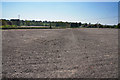
The footpath crosses a prepared field
What ever has been planted in this field has, so far, failed to grow and the dusty soil shows where the path crosses the field.
Image: © Malcolm Neal
Taken: 25 Apr 2020
0.09 miles
8
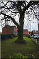
A tree on Merlin Way
The tree has been here rather longer than the majority of the houses on Merlin Way, though there is also the now converted building of the old "Pastures Hospital" behind and to the right of the picture.
Image: © Malcolm Neal
Taken: 16 Nov 2020
0.09 miles
9

Sandpiper Lane
Sandpiper Lane curves back on itself to halt in a turning circle at the very end of the cul-de-sac.
Image: © Malcolm Neal
Taken: 29 Jan 2021
0.10 miles
10

Sandpiper Lane
The houses towards the end of Sandpiper Lane seem to get larger.
Image: © Malcolm Neal
Taken: 29 Jan 2021
0.11 miles