
IMAGES TAKEN NEAR TO
Shelford Close, DERBY, DE3 0QR
Introduction
This page details the photographs taken nearby to Shelford Close, DE3 0QR by members of the Geograph project.
The Geograph project started in 2005 with the aim of publishing, organising and preserving representative images for every square kilometre of Great Britain, Ireland and the Isle of Man.

There are currently over 7.5m images from over14,400 individuals and you can help contribute to the project by visiting https://www.geograph.org.uk
Image Map
Images are licensed for reuse under creativecommons.org/licenses/by-sa/2.0
Notes
- Clicking on the map will re-center to the selected point.
- The higher the marker number, the further away the image location is from the centre of the postcode.
Image Listing (51 Images Found)
Images are licensed for reuse under creativecommons.org/licenses/by-sa/2.0
Image
Details
Distance
1
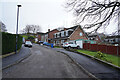
Shelford Close
Shelford Close runs up the hill to a footpath that leads to the green area above the Honeycomb public house.
Image: © Malcolm Neal
Taken: 18 Jan 2021
0.02 miles
2
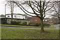
The Honeycomb Public House
The sixth public house in Mickleover. Sits in a hollow, though this is not obvious from the image.
Image: © Malcolm Neal
Taken: 14 Feb 2017
0.02 miles
3
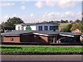
The Honeycomb
The Honeycomb was so-named because of its shape, which includes some hexagonal sections.
Image: © Ian Calderwood
Taken: 25 Oct 2013
0.02 miles
4
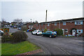
Milton Close
Looking up the hill from Milton Close towards Ladybank Road.
Image: © Malcolm Neal
Taken: 18 Jan 2021
0.05 miles
5
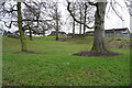
A small green in Mickleover
A green area with large trees and a hollow. Not much good for ball games but a pleasant place for young children to run around.
Image: © Malcolm Neal
Taken: 18 Jan 2021
0.05 miles
6

At the end of Barnwell Close
I think this is an unofficial parking area behind the houses at the end of Barnwell Close.
Image: © Malcolm Neal
Taken: 18 Jan 2021
0.06 miles
7
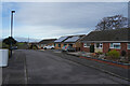
Brampton Close
As the name suggests this is a cul-de-sac at least for road traffic. At the far end of which is a footpath that leads to a range of other paths behind and between other rows of houses.
Image: © Malcolm Neal
Taken: 18 Jan 2021
0.06 miles
8

Footpaths from Brampton Close
There are a series of paved footpaths that run to various parts of Mickleover from the end of Brampton Close.
Image: © Malcolm Neal
Taken: 18 Jan 2021
0.07 miles
9
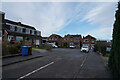
Ashton Close
Ashton Close is a cul-de-sac that links to Kingsmuir Road, though this is the opposite end from the junction.
Image: © Malcolm Neal
Taken: 18 Jan 2021
0.07 miles
10

The Great Northern Greenway
The Great Northern Greenway is part of the National Cycle track system. This part of the track runs from Mickleover to Etwall and then beyond and is numbered route 68.
Image: © Malcolm Neal
Taken: 26 Feb 2021
0.08 miles