IMAGES TAKEN NEAR TO
Islay Road, DERBY, DE24 9LG
Introduction
This page details the photographs taken nearby to Islay Road, DE24 9LG by members of the Geograph project.
The Geograph project started in 2005 with the aim of publishing, organising and preserving representative images for every square kilometre of Great Britain, Ireland and the Isle of Man.

There are currently over 7.5m images from over14,400 individuals and you can help contribute to the project by visiting https://www.geograph.org.uk
Image Map
Images are licensed for reuse under creativecommons.org/licenses/by-sa/2.0
Notes
- Clicking on the map will re-center to the selected point.
- The higher the marker number, the further away the image location is from the centre of the postcode.
Image Listing (9 Images Found)
Images are licensed for reuse under creativecommons.org/licenses/by-sa/2.0
Image
Details
Distance
1
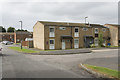
Montrose Close
Just off Grampian Way these are fairly small house in short terraced rows.
Image: © Malcolm Neal
Taken: 30 Jun 2017
0.13 miles
2
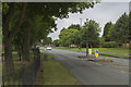
Grampian Way
The ever curving road Grampian Way runs through the suburb of Sinfin. It has relatively new houses i.e. between 20 to 30 years old.
Image: © Malcolm Neal
Taken: 30 Jun 2017
0.17 miles
3
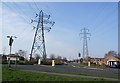
Pylons part company, Sinfin
A junction in the road also marks the parting of two runs of pylons.
Image: © Nikki Mahadevan
Taken: 6 Feb 2007
0.19 miles
4
Blue bus on Grampian Way
Near the junction with Morlich Drive, Derby suburbs.
Image: © Peter Barr
Taken: 25 May 2012
0.21 miles
6
Housing on Grampian Way, Sinfin
Taking the form of low rise flats.
Image: © Richard Vince
Taken: 2 Feb 2019
0.22 miles
8
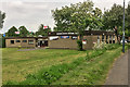
Sinfin Moor Social Club
Sinfin Moor Social Club on Arleston Lane.
Image: © David Dixon
Taken: 13 May 2017
0.22 miles