
IMAGES TAKEN NEAR TO
Haig Street, DERBY, DE24 8RJ
Introduction
This page details the photographs taken nearby to Haig Street, DE24 8RJ by members of the Geograph project.
The Geograph project started in 2005 with the aim of publishing, organising and preserving representative images for every square kilometre of Great Britain, Ireland and the Isle of Man.

There are currently over 7.5m images from over14,400 individuals and you can help contribute to the project by visiting https://www.geograph.org.uk
Image Map
Images are licensed for reuse under creativecommons.org/licenses/by-sa/2.0
Notes
- Clicking on the map will re-center to the selected point.
- The higher the marker number, the further away the image location is from the centre of the postcode.
Image Listing (24 Images Found)
Images are licensed for reuse under creativecommons.org/licenses/by-sa/2.0
Image
Details
Distance
1
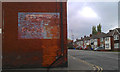
Wall advertisement
An old painted sign on the end of Haig Street, Crewton
Image: © David Lally
Taken: 18 May 2013
0.06 miles
2
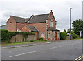
997 London Road
The immediate purpose of this building is not apparent, but it turns out to be a more than usually imposing example of a turnpike toll house, dating from the mid 19th century, now a private dwelling. The rear of the building is a modern extension. Listed Grade II.
Image: © Alan Murray-Rust
Taken: 14 Aug 2013
0.06 miles
3
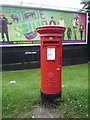
Elizabeth II postbox on London Road
Postbox No. DE24 138.
See Image] for context.
Image: © JThomas
Taken: 21 Jul 2016
0.07 miles
4

London Road, Derby
Showing position of Postbox No. DE24 138.
See Image] for postbox.
Image: © JThomas
Taken: 21 Jul 2016
0.07 miles
5
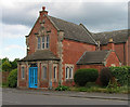
Tollhouse by the A6, London Road, Alvaston
Tollhouse by the A6, in the parish of Derby (Derby District), No. 997, London Road, Alvaston, DE24 8PX.
Grade II listed.
List Entry Number: 1287100 https://historicengland.org.uk/listing/the-list/list-entry/1287100
Surveyed
Milestone Society National ID: DE.DER04
Image: © Alan Rosevear
Taken: 3 Jun 2005
0.07 miles
6
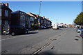
London Road
In a suburb of Derby named Crewton, London Road or the A6 is one of the main arteries that lead into and out of the city.
Image: © Malcolm Neal
Taken: 12 Feb 2020
0.07 miles
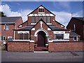
8
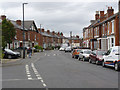
Brighton Road, Crewton
Housing development from the early years of the 20th century.
Image: © Alan Murray-Rust
Taken: 14 Aug 2013
0.12 miles
9
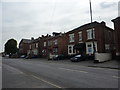
Substantial semis on London Road, Alvaston
Edwardian semi-detached, some for rent.
Image: © Peter Barr
Taken: 26 Jul 2011
0.13 miles
10
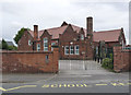
St Martins School
Built in 1904. Latterly a special needs school for 11 to 18 year olds, now located on a new campus.
Image: © Alan Murray-Rust
Taken: 14 Aug 2013
0.13 miles