
IMAGES TAKEN NEAR TO
Mortimer Street, DERBY, DE24 8FW
Introduction
This page details the photographs taken nearby to Mortimer Street, DE24 8FW by members of the Geograph project.
The Geograph project started in 2005 with the aim of publishing, organising and preserving representative images for every square kilometre of Great Britain, Ireland and the Isle of Man.

There are currently over 7.5m images from over14,400 individuals and you can help contribute to the project by visiting https://www.geograph.org.uk
Image Map
Images are licensed for reuse under creativecommons.org/licenses/by-sa/2.0
Notes
- Clicking on the map will re-center to the selected point.
- The higher the marker number, the further away the image location is from the centre of the postcode.
Image Listing (9 Images Found)
Images are licensed for reuse under creativecommons.org/licenses/by-sa/2.0
Image
Details
Distance
1
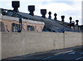
Derby - cowls at Rolls-Royce
Rooftop cowls on that part of the former Rolls-Royce works that backs onto Addison Road.
Image: © Dave Bevis
Taken: 12 Nov 2010
0.12 miles
2
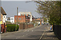
Nightingale Road
This road used to be the home of part of Rolls Royce Derby. All that is left now is the facade of the entrance. The rest has been demolished and awaits development, probably for housing.
Image: © Malcolm Neal
Taken: 8 Apr 2017
0.18 miles
3
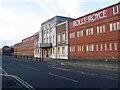
Derby - Rolls-Royce Factory
An alternative view (taken in 2005 when the factory was still operational) is available at Image The frontage was boarded up in 2008 and much of the works behind has been demolished since then.
Image: © Dave Bevis
Taken: 12 Nov 2010
0.20 miles
4
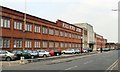
Rolls Royce works, Nightingale Road, Derby
Image: © Chris J Dixon
Taken: 22 Apr 2005
0.21 miles
6

Shops on Elton Road
A Post Office, barbers and fish and chip shop.
Image: © DS Pugh
Taken: 2 Aug 2025
0.24 miles
8
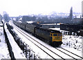
Snowy Suburbia
With snow falling, a Taunton to Newcastle train passes through Pear Tree on the approach to its next stop at Derby.
Image: © Peter Kazmierczak
Taken: 21 Dec 1981
0.25 miles
9
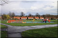
Play area in Osmaston Park
The play area is recently constructed using external funding. The equipment shown is intended for younger children but the whole area is a lot larger than seen in the photo and includes equipment for older children as well.
The play area is an outcome of a resident driven project to re-habilitate the neglected park which is supposed to serve one of the most deprived areas in Derby.
Osmaston Park is on the south side of Osmaston Park Road (part of so called Derby Ring Road which is not a ring in fact). The houses seen from their rear are on Osmaston Park Road.
Image: © Robin Turner
Taken: 30 Mar 2010
0.25 miles