
IMAGES TAKEN NEAR TO
Deepdale Lane, DERBY, DE24 3JY
Introduction
This page details the photographs taken nearby to Deepdale Lane, DE24 3JY by members of the Geograph project.
The Geograph project started in 2005 with the aim of publishing, organising and preserving representative images for every square kilometre of Great Britain, Ireland and the Isle of Man.

There are currently over 7.5m images from over14,400 individuals and you can help contribute to the project by visiting https://www.geograph.org.uk
Image Map
Images are licensed for reuse under creativecommons.org/licenses/by-sa/2.0
Notes
- Clicking on the map will re-center to the selected point.
- The higher the marker number, the further away the image location is from the centre of the postcode.
Image Listing (11 Images Found)
Images are licensed for reuse under creativecommons.org/licenses/by-sa/2.0
Image
Details
Distance

3
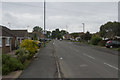
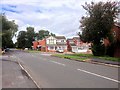
Deep Dale Lane
The edge of Derby is the suburb of Stenson Fields and Deep Dale Lane is the very edge of that suburb.
Image: © Malcolm Neal
Taken: 30 Jun 2017
0.14 miles
4
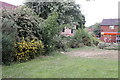
Overgrown hedge at rear of Jarvis Court, Sinfin, Derby
Jarvis Court: Jarvis Court, amenity housing, unsupported housing for older people based in Derby, run by FCH Housing & Care.
It lies within the City of Derby Unitary Authority area. Access by road is solely through the minor authority area of South Derbyshire District Council - the major authority being Derbyshire County Council.
Image: © Robin Turner
Taken: 6 Jul 2010
0.17 miles
5
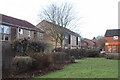
Hedge now trimmed at rear of Jarvis Court, Sinfin Derby
Residents of Jarvis Court now have a view of the sky and the Public Open Space because the hedge has been trimmed following my complaint on behalf of my constituents.
Image: © Robin Turner
Taken: 13 Dec 2010
0.19 miles
6
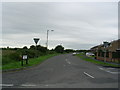
Wragley Way, Stenson Fields, Derby
Wragley Way forms the edge of the urban development to the South West of Derby
Image: © Philip Grimshaw
Taken: 11 Sep 2005
0.20 miles
7
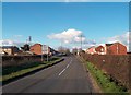
Derby and Sinfin Entrance Sign
Approaching the southern edges of Sinfin from Deep Dale Lane. The dwellings visible here are facing out onto open countryside.
Image: © Jonathan Clitheroe
Taken: 1 Mar 2014
0.20 miles
8
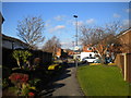
Footpath to Jedburgh Close, Sinfin
Off Wragley Way.
Image: © Richard Vince
Taken: 2 Feb 2019
0.23 miles

10

Frozen Wragley Way
A very cold night (22.45 & down to -13!) on Wragley Way (Sinfin) looking towards Deep Dale Lane, taken from the alleyway to Jedburgh Close.
Image: © ROSE BEAVAN
Taken: 6 Dec 2010
0.24 miles