IMAGES TAKEN NEAR TO
Brunswick Street, DERBY, DE23 8TQ
Introduction
This page details the photographs taken nearby to Brunswick Street, DE23 8TQ by members of the Geograph project.
The Geograph project started in 2005 with the aim of publishing, organising and preserving representative images for every square kilometre of Great Britain, Ireland and the Isle of Man.

There are currently over 7.5m images from over14,400 individuals and you can help contribute to the project by visiting https://www.geograph.org.uk
Image Map
Images are licensed for reuse under creativecommons.org/licenses/by-sa/2.0
Notes
- Clicking on the map will re-center to the selected point.
- The higher the marker number, the further away the image location is from the centre of the postcode.
Image Listing (30 Images Found)
Images are licensed for reuse under creativecommons.org/licenses/by-sa/2.0
Image
Details
Distance
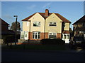
2
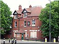
The Cavendish Hotel
The Cavendish was built in 1898 and, judging by old photographs, was initially quite prosperous. By the 2000s, however, it had become seriously run-down and was closed down. It was offered for sale in 2010, either as a going concern or for redevelopment, but there would appear to have been no takers.
Image: © Ian Calderwood
Taken: 31 May 2014
0.13 miles
3
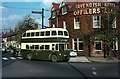
Derby trolleybus 233 at Cavendish, 1966
Cavendish was the nominal terminus of a loop route to the south west of the city centre which also encompassed the Midland Station, for which it is headed. Nominally it should be showing route number 33, changing to 32 at the station.
The Cavendish Hotel, which gave its name to the location closed in around 2014 and a few years later had been converted into a grocery store.
Image: © Alan Murray-Rust
Taken: 15 Oct 1966
0.13 miles
5
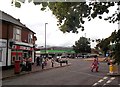
Post Office and Shopping Area in Normanton
Pictured here from Stenson Road on a busy Saturday afternoon.
Image: © Jonathan Clitheroe
Taken: 24 Aug 2013
0.14 miles
6
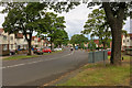
Kenilwoth Avenue (A5111)
Inner ring road in the Normanton district of derby.
Image: © David Dixon
Taken: 13 May 2017
0.14 miles
7
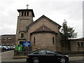
Church of St. George and All Soldier Saints
Designed by J.S. Brocklesby 1920 and of necessity rebuilt in 1929 by C.A. Edeson.
Image: © Jonathan Thacker
Taken: 21 Mar 2015
0.17 miles
9
East end of Havelock Road, Peartree
Seen from St Thomas Road.
Image: © Richard Vince
Taken: 4 May 2019
0.17 miles