
IMAGES TAKEN NEAR TO
Baseball Drive, DERBY, DE23 8NE
Introduction
This page details the photographs taken nearby to Baseball Drive, DE23 8NE by members of the Geograph project.
The Geograph project started in 2005 with the aim of publishing, organising and preserving representative images for every square kilometre of Great Britain, Ireland and the Isle of Man.

There are currently over 7.5m images from over14,400 individuals and you can help contribute to the project by visiting https://www.geograph.org.uk
Image Map
Images are licensed for reuse under creativecommons.org/licenses/by-sa/2.0
Notes
- Clicking on the map will re-center to the selected point.
- The higher the marker number, the further away the image location is from the centre of the postcode.
Image Listing (16 Images Found)
Images are licensed for reuse under creativecommons.org/licenses/by-sa/2.0
Image
Details
Distance
1
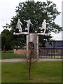
Baseball Ground statue
A commemorative statue on the site of the former home of Derby County FC. The ground was demolished in 2003 to make way for a housing development, the football team moving to a new ground on a business park beside the River Derwent Image
Image: © Graham Hogg
Taken: 18 Aug 2012
0.06 miles
2
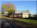
Shaftesbury Sports Centre
Boarded up and vandalised, according to the council, they are "... seeking a suitable group or organisation to take over the management of a former sports centre which desperately needs a new lease of life".
Image: © Ian Calderwood
Taken: 2 Nov 2018
0.11 miles
3
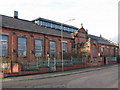
Derby - Ley's Mess Room, Osmaston
Apparently, this was the mess room for Ley's Malleable Castings in Colombo Street, Derby.
Image: © Dave Bevis
Taken: 19 Feb 2009
0.16 miles
4
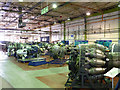
Rolls Royce Heritage Trust collection
Part of the vast collection of (mainly) aero engines produced by Rolls Royce and its associated companies, housed in the former Light Alloys works on Osmaston Road and looked after by the Trust http://www.rolls-royce.com/about/heritage/heritage_trust/. The building was formerly a depot for the Derby Corporation trolleybus fleet.
Image: © Alan Murray-Rust
Taken: 14 Aug 2013
0.20 miles
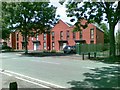
6
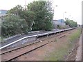
Derby Ramsline Halt railway station
Opened in 1990 by British Rail for football specials, just south of Derby station on the line to Birmingham. Apparently only 4 trains ever called there and the station closed in 1997.
View north towards Derby, from a passing train.
Image: © Nigel Thompson
Taken: 29 Apr 2011
0.22 miles
7
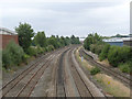
Midland Railway to Birmingham
Looking south from Osmaston Road bridge.
Image: © Alan Murray-Rust
Taken: 14 Aug 2013
0.22 miles
8
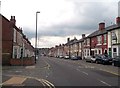
Dairy House Road in Rose Hill
Pictured here at its junction with Catherine Street on the left of picture.
Image: © Jonathan Clitheroe
Taken: 24 Aug 2013
0.22 miles
9
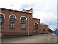
From buses to planes?
When these buildings in Osmaston Road were visited in 2005 they contained a selection of aero-engines and other aviation material and were being run privately as a museum of Derby’s activities in the aerospace industry, with particular reference to Rolls-Royce. In earlier days they are believed to have housed trams and buses of the Derby Corporation Transport fleet.
Image: © A-M-Jervis
Taken: 8 Sep 2005
0.22 miles
10
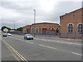
Former trolleybus depot, Osmaston Road
After the move of the fleet to the new Derby Corporation garage on Ascot Drive, this became part of the Rolls Royce Light Alloys foundry site. It now contains the Rolls Royce Heritage Trust's collection http://www.rolls-royce.com/about/heritage/heritage_trust/ http://www.geograph.org.uk/photo/3645091
Image: © Alan Murray-Rust
Taken: 14 Aug 2013
0.23 miles