
IMAGES TAKEN NEAR TO
Cambridge Street, DERBY, DE23 8HH
Introduction
This page details the photographs taken nearby to Cambridge Street, DE23 8HH by members of the Geograph project.
The Geograph project started in 2005 with the aim of publishing, organising and preserving representative images for every square kilometre of Great Britain, Ireland and the Isle of Man.

There are currently over 7.5m images from over14,400 individuals and you can help contribute to the project by visiting https://www.geograph.org.uk
Image Map
Images are licensed for reuse under creativecommons.org/licenses/by-sa/2.0
Notes
- Clicking on the map will re-center to the selected point.
- The higher the marker number, the further away the image location is from the centre of the postcode.
Image Listing (11 Images Found)
Images are licensed for reuse under creativecommons.org/licenses/by-sa/2.0
Image
Details
Distance
1
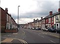
Dairy House Road in Rose Hill
Pictured here at its junction with Catherine Street on the left of picture.
Image: © Jonathan Clitheroe
Taken: 24 Aug 2013
0.05 miles
2
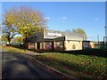
Shaftesbury Sports Centre
Boarded up and vandalised, according to the council, they are "... seeking a suitable group or organisation to take over the management of a former sports centre which desperately needs a new lease of life".
Image: © Ian Calderwood
Taken: 2 Nov 2018
0.11 miles
3
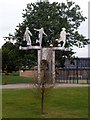
Baseball Ground statue
A commemorative statue on the site of the former home of Derby County FC. The ground was demolished in 2003 to make way for a housing development, the football team moving to a new ground on a business park beside the River Derwent Image
Image: © Graham Hogg
Taken: 18 Aug 2012
0.13 miles
5
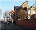
Derby - Arboretum vicinity
Although the address of this property is No.86, Rose Hill Street the main pedestrian entrance appears to be here on Wilfred Street. This Jacobean-style house (c.1822) is the second property to have been built on this site and this one is thought to have been designed by Joseph Strutt, the Arboretum benefactor. The west gable is in Flemish style and the south gable sports a large sundial set into a stone surround. The far end elevation overlooks Rose Hill Recreation Ground, that borders the Arboretum. In Rose Hill Street there is a large yard, perhaps used for coaches and stabling in the past. As "Rosehill House" it may now be being used as a residential care facility?
Image: © David Hallam-Jones
Taken: 13 Dec 2012
0.19 miles
6
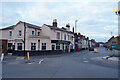
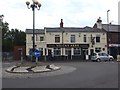
The Vulcan Arms
A pub that is still open for business, but not at the moment as it is quite early in the morning before opening time. This pub is never likely to open early as the police station for the area is about 40 metres away.
Image: © Malcolm Neal
Taken: 16 Oct 2021
0.20 miles
7
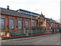
Derby - Ley's Mess Room, Osmaston
Apparently, this was the mess room for Ley's Malleable Castings in Colombo Street, Derby.
Image: © Dave Bevis
Taken: 19 Feb 2009
0.21 miles
8
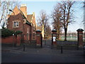
Derby - Arboretum
The Rose Hill Street entrance/exit. Behind the lodge the former Joseph Strutt Bowling Club can be seen - "the oldest crown bowling green in England" - the club house of which is now occupied by The Butterfly Project (see www.butterflyproject.co.uk).
Image: © David Hallam-Jones
Taken: 13 Dec 2012
0.23 miles
9
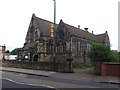
St Thomas Church
Anglican church in central Derby.
Image: © Graham Hogg
Taken: 18 Aug 2012
0.23 miles
10
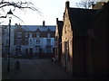
Derby - Arboretum
A section of Rose Hill Street seen from inside the Arboretum with a former lodge house and pedestrian entrance/exit. The former Joseph Strutt bowling club - "the oldest crown bowling green in England" - is situated behind the lodge and its club house is currently being used by The Butterfly Project (see www.butterflyproject.co.uk).
Image: © David Hallam-Jones
Taken: 13 Dec 2012
0.24 miles