
IMAGES TAKEN NEAR TO
Grange Street, DERBY, DE23 8HA
Introduction
This page details the photographs taken nearby to Grange Street, DE23 8HA by members of the Geograph project.
The Geograph project started in 2005 with the aim of publishing, organising and preserving representative images for every square kilometre of Great Britain, Ireland and the Isle of Man.

There are currently over 7.5m images from over14,400 individuals and you can help contribute to the project by visiting https://www.geograph.org.uk
Image Map
Images are licensed for reuse under creativecommons.org/licenses/by-sa/2.0
Notes
- Clicking on the map will re-center to the selected point.
- The higher the marker number, the further away the image location is from the centre of the postcode.
Image Listing (69 Images Found)
Images are licensed for reuse under creativecommons.org/licenses/by-sa/2.0
Image
Details
Distance
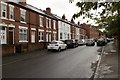
2
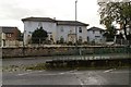
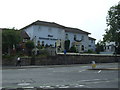
Hotel Ristorante La Gondola (closed)
This similar view from 2013 shows the hotel when it was still open: Image
Image: © Mark Anderson
Taken: 24 Sep 2019
0.05 miles
4
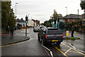
Osmaston Road
At the junction with Ivy Square.
Image: © Mark Anderson
Taken: 24 Sep 2019
0.08 miles
5
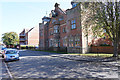
The facade of Reginald Street Baths
As a child I remember going here to swim in the Reginald Street swimming pool. When the pool was condemned it was decided to save the frontage and this has been turned into flats. This has improved the area a good deal.
Image: © Malcolm Neal
Taken: 19 Sep 2019
0.09 miles
6
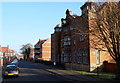
Derby - Arboretum vicinity
Although the architect, Alexander MacPherson, (1847-1935), was born in Nottingham he worked mainly in and around Derby, somewhere he had to moved in 1880. He designed the Reginald Street public baths c.1904 - in Jacobean style - and it appears that they were built under the direction of John Ward, the Borough Surveyor at a cost of £24,000. They closed in 1982 and are currently occupied by the residents of a care home. Apparently the former swimming area still boasts a large bath with tiled walls with a gallery that is railed on three sides and a Turkish bath that has marble walls and arched inward curving screen consisting of three Islamic arches. The clock was made by John Smith, the famous Derby clock manufacturing company. The site of the former Arboretum's East Lodge lies obliquely opposite this building and Osmaston Road (the A514) is situated in the distance.
Image: © David Hallam-Jones
Taken: 13 Dec 2012
0.10 miles
7
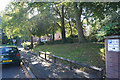
The end of Sidney Street
A well wooded street of new houses that has replaced old terraced housing. Just beyond the image to the left the road curves to the left and becomes Barlow Street.
Image: © Malcolm Neal
Taken: 19 Sep 2019
0.11 miles
8
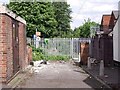
Douglas Street
This closed-off section of Douglas Street used to lead to Ivy House School for children with special needs, which relocated to Littleover in 2009.
Image: © Ian Calderwood
Taken: 27 May 2013
0.11 miles
10
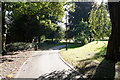
At the east end of the Arboretum
At the east end the park ends at Reginald Street which is just outside the image. Even here you can see one of the lower banks that divide the paths from each other.
Image: © Malcolm Neal
Taken: 19 Sep 2019
0.12 miles