
IMAGES TAKEN NEAR TO
Lyndhurst Street, DERBY, DE23 6WH
Introduction
This page details the photographs taken nearby to Lyndhurst Street, DE23 6WH by members of the Geograph project.
The Geograph project started in 2005 with the aim of publishing, organising and preserving representative images for every square kilometre of Great Britain, Ireland and the Isle of Man.

There are currently over 7.5m images from over14,400 individuals and you can help contribute to the project by visiting https://www.geograph.org.uk
Image Map
Images are licensed for reuse under creativecommons.org/licenses/by-sa/2.0
Notes
- Clicking on the map will re-center to the selected point.
- The higher the marker number, the further away the image location is from the centre of the postcode.
Image Listing (56 Images Found)
Images are licensed for reuse under creativecommons.org/licenses/by-sa/2.0
Image
Details
Distance
1
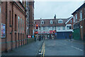
Rosehill Street
At the end of Rosehill Street looking roughly west towards Normanton Road which is the road along which the visible shops are.
Image: © Malcolm Neal
Taken: 30 Dec 2021
0.05 miles
2
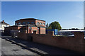
The Church of God
A 7th Day Adventist church is a modern building on the edge of a modern trading estate.
Image: © Malcolm Neal
Taken: 14 Sep 2019
0.05 miles
3
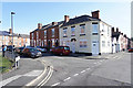
Looking across Bainbrigge Street
The white house stands on the corner of Bainbrigge Street and by the corner where the house with all the solar panels is the street becomes Dashwood Street.
Image: © Malcolm Neal
Taken: 14 Sep 2019
0.07 miles
4
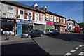
Shops on Normanton Road
Normanton Road is full of independent shops selling a wide variety of goods. Many of the shops are of an ethnic variety.
Image: © Malcolm Neal
Taken: 14 Sep 2019
0.08 miles
5
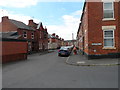
Junction Industrial Street and Society Place
With The Falstaff Free House.
Image: © Chris Gunns
Taken: 24 May 2012
0.08 miles
6
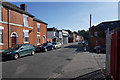
The end of Moore Street
Moore street ends just ahead as it meets Normanton Road. This is the main road into the area known as Normanton. This is mainly older terraced housing and has terrible parking problems.
Image: © Malcolm Neal
Taken: 14 Sep 2019
0.08 miles
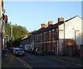
9
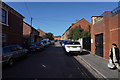
Looking up Dashwood Street
Standing just in Dashwood Street from the Normanton Road end there is an interesting reflection, from the car parked half on the pavement, in the middle of the shadow area on the road.
Image: © Malcolm Neal
Taken: 19 Sep 2019
0.10 miles
10
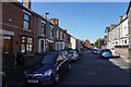
Parking on the pavement
With the recent call to ban such parking, you see the problems it may cause, because if the cars were not on the pavement then any emergency service ambulance or fire engine could not travel along the road!
Image: © Malcolm Neal
Taken: 14 Sep 2019
0.12 miles