
IMAGES TAKEN NEAR TO
Southgate Retail Park, Normanton Road, DERBY, DE23 6UQ
Introduction
This page details the photographs taken nearby to Southgate Retail Park, Normanton Road, DE23 6UQ by members of the Geograph project.
The Geograph project started in 2005 with the aim of publishing, organising and preserving representative images for every square kilometre of Great Britain, Ireland and the Isle of Man.

There are currently over 7.5m images from over14,400 individuals and you can help contribute to the project by visiting https://www.geograph.org.uk
Image Map
Images are licensed for reuse under creativecommons.org/licenses/by-sa/2.0
Notes
- Clicking on the map will re-center to the selected point.
- The higher the marker number, the further away the image location is from the centre of the postcode.
Image Listing (94 Images Found)
Images are licensed for reuse under creativecommons.org/licenses/by-sa/2.0
Image
Details
Distance
1

The Yoga Centre
This is the end of Mount Street where it joins Mill Hill Lane. There is a new business estate with The Yoga Centre, many shops and a garage beyond Mill Hill Lane.
Image: © Malcolm Neal
Taken: 14 Sep 2019
0.01 miles
2

Ozzy Road Church
Osmaston Road Baptist Church.
Image: © Peter Barr
Taken: 8 Mar 2012
0.05 miles
3

Mount Street
At the other end of Mount Street from Centenary House is this terrace of private houses.
Image: © Malcolm Neal
Taken: 14 Sep 2019
0.05 miles
4

Southgate Retail Park
A fairly modern retail park which extends out to Mill Hill Lane. This is the site of the first Lidl in Derby which is just off to the left of the image.
Image: © Malcolm Neal
Taken: 14 Sep 2019
0.05 miles
5

Avondale Road
This is where Avondale Road meets Renals Street on this right angled corner which goes out to the left of the image.
Image: © Malcolm Neal
Taken: 14 Sep 2019
0.06 miles

7

Charnwood Street
Charnwood Street near the city centre has an interesting mix of buildings that are mainly older housing stock.
Image: © Malcolm Neal
Taken: 14 Sep 2019
0.08 miles
8
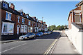
Mill Hill Lane
Older palisaded houses on Mill Hill Lane. As with lots of older houses in this area there is no off road parking and so the streets behind are very congested. Here there are no houses on the right and there are no parking yellow lines on the road.
Image: © Malcolm Neal
Taken: 14 Sep 2019
0.09 miles
9
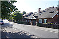
Centenary House, Mount Street
Centenary House is a hostel for homeless people near the centre of Derby. It can cater for up to 32 people with private bedrooms and shared washing facilities.
Image: © Malcolm Neal
Taken: 14 Sep 2019
0.09 miles
10
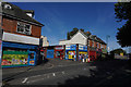
Belgrave Street joins Normanton Road
Yet more brightly painted shops some of which are shuttered because they are not yet open.
Image: © Malcolm Neal
Taken: 14 Sep 2019
0.10 miles