
IMAGES TAKEN NEAR TO
Renals Street, DERBY, DE23 6SJ
Introduction
This page details the photographs taken nearby to Renals Street, DE23 6SJ by members of the Geograph project.
The Geograph project started in 2005 with the aim of publishing, organising and preserving representative images for every square kilometre of Great Britain, Ireland and the Isle of Man.

There are currently over 7.5m images from over14,400 individuals and you can help contribute to the project by visiting https://www.geograph.org.uk
Image Map
Images are licensed for reuse under creativecommons.org/licenses/by-sa/2.0
Notes
- Clicking on the map will re-center to the selected point.
- The higher the marker number, the further away the image location is from the centre of the postcode.
Image Listing (77 Images Found)
Images are licensed for reuse under creativecommons.org/licenses/by-sa/2.0
Image
Details
Distance
1
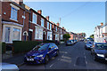
Renals Street
The road is clearly marked for permit parking but even then there is little space as many of the houses have two or more cars to park.
Image: © Malcolm Neal
Taken: 14 Sep 2019
0.02 miles
2

Avondale Road
This is where Avondale Road meets Renals Street on this right angled corner which goes out to the left of the image.
Image: © Malcolm Neal
Taken: 14 Sep 2019
0.04 miles
3
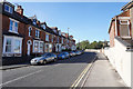
Mill Hill Lane
Older palisaded houses on Mill Hill Lane. As with lots of older houses in this area there is no off road parking and so the streets behind are very congested. Here there are no houses on the right and there are no parking yellow lines on the road.
Image: © Malcolm Neal
Taken: 14 Sep 2019
0.05 miles
4
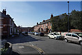
Salisbury Street
Salisbury Street with Belgrave Street off to the left. Car parking is a problem with some being partly on the pavement.
Image: © Malcolm Neal
Taken: 14 Sep 2019
0.05 miles
5
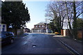
Mill Hill Lane
A shaded Mill Hill Lane on a bright but cold morning. The building and fencing towards the middle top is the entrance to St. Joseph's Catholic Primary School.
Image: © Malcolm Neal
Taken: 27 Feb 2020
0.07 miles
6
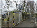
Site of a former Catholic Church
St. Joseph's on Mill Hill Lane.
Image: © Peter Barr
Taken: 8 Mar 2012
0.08 miles
7
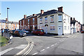
Looking across Bainbrigge Street
The white house stands on the corner of Bainbrigge Street and by the corner where the house with all the solar panels is the street becomes Dashwood Street.
Image: © Malcolm Neal
Taken: 14 Sep 2019
0.09 miles
8
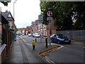
Traffic calming statue
One of several models of small children in the area placed to encourage motorists to drive carefully.
Image: © Graham Hogg
Taken: 18 Aug 2012
0.09 miles
9
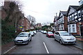
Lime Avenue
A cul-de-sac with a turning circle at its head, Lime Avenue was once a very prosperous avenue but has lately fallen on harder times.
Image: © Malcolm Neal
Taken: 21 Feb 2020
0.09 miles
10
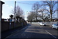
Mill Hill Lane
Further along Mill Hill Lane showing the security fencing for the primary school on this bright sunny but cold morning.
Image: © Malcolm Neal
Taken: 27 Feb 2020
0.09 miles