
IMAGES TAKEN NEAR TO
Valley Road, DERBY, DE23 6HQ
Introduction
This page details the photographs taken nearby to Valley Road, DE23 6HQ by members of the Geograph project.
The Geograph project started in 2005 with the aim of publishing, organising and preserving representative images for every square kilometre of Great Britain, Ireland and the Isle of Man.

There are currently over 7.5m images from over14,400 individuals and you can help contribute to the project by visiting https://www.geograph.org.uk
Image Map
Images are licensed for reuse under creativecommons.org/licenses/by-sa/2.0
Notes
- Clicking on the map will re-center to the selected point.
- The higher the marker number, the further away the image location is from the centre of the postcode.
Image Listing (57 Images Found)
Images are licensed for reuse under creativecommons.org/licenses/by-sa/2.0
Image
Details
Distance
1
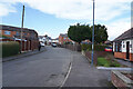
Littleover Crescent
Close to the end of the crescent where it joins to Valley Road. The two storey houses are all on Valley Road.
Image: © Malcolm Neal
Taken: 13 Mar 2021
0.04 miles
2

South Avenue
This is the bottom of South Avenue just above where it joins to Valley Road. To stop South Avenue being used as a rat run this lower junction has a no entry sign stopping traffic from entering.
Image: © Malcolm Neal
Taken: 12 Mar 2021
0.04 miles
3
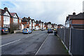
Penrhyn Avenue
Penrhyn Avenue is a curving road whose curve runs parallel to that of Littleover Crescent a little to the west. The houses here are nearly all two storey semi-detached houses rather than the bungalows in Littleover Crescent.
Image: © Malcolm Neal
Taken: 13 Mar 2021
0.06 miles
4
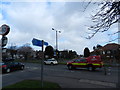
Junction of Manor Road, with Valley Road
Cycle route signs show routes avoiding the busier roads.
Image: © Peter Barr
Taken: 8 Mar 2012
0.07 miles
5
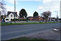
Warwick Avenue
Looking back across Warwick Avenue towards Carlton Road. This is one road that still allows traffic to leave and join the ring road.
Image: © Malcolm Neal
Taken: 12 Mar 2021
0.08 miles
6
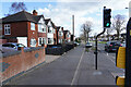
Warwick Avenue
Warwick Avenue is part of the outer ring road. The wide pavement with some grassy verges is used for resident parking as it is far too dangerous to park on the ring road.
Image: © Malcolm Neal
Taken: 12 Mar 2021
0.08 miles
7
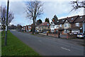
Warwick Avenue
Standing on the central reservation and trying not to stand on the Daffodils which brighten it. This is last of the centi-squares in SK3334 completing yet another grid square in Derby with an at least 100 images with 1 in each and every centi-square.
Image: © Malcolm Neal
Taken: 13 Mar 2021
0.09 miles
8
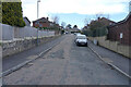
Broughton Avenue
Looking up Broughton Avenue with at the very top the Free Mason's East Midlands head quarters the Grange Banqueting Hall.
Image: © Malcolm Neal
Taken: 13 Mar 2021
0.09 miles
9
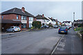
Shaldon Drive
Connecting South Avenue to Mostyn Avenue the almost flat Shaldon Drive makes a nice change from the slopes of the other two residential streets.
Image: © Malcolm Neal
Taken: 13 Mar 2021
0.10 miles
10
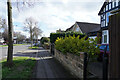
Warwick Avenue
Looking along Warwick Avenue towards the Cavendish.
Image: © Malcolm Neal
Taken: 12 Mar 2021
0.10 miles