
IMAGES TAKEN NEAR TO
Normanton Lane, DERBY, DE23 6GQ
Introduction
This page details the photographs taken nearby to Normanton Lane, DE23 6GQ by members of the Geograph project.
The Geograph project started in 2005 with the aim of publishing, organising and preserving representative images for every square kilometre of Great Britain, Ireland and the Isle of Man.

There are currently over 7.5m images from over14,400 individuals and you can help contribute to the project by visiting https://www.geograph.org.uk
Image Map
Images are licensed for reuse under creativecommons.org/licenses/by-sa/2.0
Notes
- Clicking on the map will re-center to the selected point.
- The higher the marker number, the further away the image location is from the centre of the postcode.
Image Listing (61 Images Found)
Images are licensed for reuse under creativecommons.org/licenses/by-sa/2.0
Image
Details
Distance
1
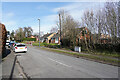
Normanton Lane
Looking across Normanton Lane up the hill towards Shepherd Street. The trees on the right border what used to be, and may still be, the sports field of St. Peter's School, Littleover.
Image: © Malcolm Neal
Taken: 13 Feb 2021
0.05 miles
2
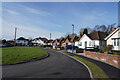
Beechwood Crescent
Beechwood Crescent is a circle of houses that are very quiet. There is a single road entry to the crescent and really only residents use it so it is very quiet even in the very busy suburb of Littleover.
Image: © Malcolm Neal
Taken: 13 Feb 2021
0.07 miles
3
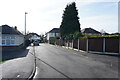
Beechwood Crescent
This is the entrance to Beechwood Crescent which is a narrow road off Brayfield Road.
Image: © Malcolm Neal
Taken: 13 Feb 2021
0.07 miles
4
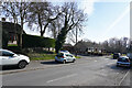
Old Vicarage Close
The street just ahead of the two parked cars on the left is Old Vicarage Close which branches off Normanton Lane which is really a change of name from Shepherd Street on this continuous right of way.
Image: © Malcolm Neal
Taken: 13 Feb 2021
0.07 miles
5
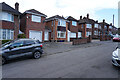
Glebe Rise
As the name suggests Glebe Rise is a fairly steep hill with detached houses to both sides.
Image: © Malcolm Neal
Taken: 13 Mar 2021
0.10 miles
6
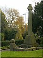
Littleover War Memorial
A substantial cross of Celtic wheel-head form, erected in 1921 and dedicated in 1922. Listed Grade II.
Image: © Alan Murray-Rust
Taken: 5 Nov 2017
0.11 miles
7
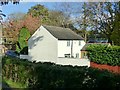
15 Normanton Lane, Littleover
A very plain building, early 19th century, Listed Grade II for its contribution to the street scene.
Image: © Alan Murray-Rust
Taken: 5 Nov 2017
0.11 miles
8
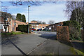
Barncroft House
Barncroft is a sheltered housing development for people over 55 years of age and is found at the end of Brayfield Road.
Image: © Malcolm Neal
Taken: 13 Feb 2021
0.11 miles
9
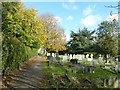
The churchyard, Littleover
The footpath is a public right of way.
Image: © Alan Murray-Rust
Taken: 5 Nov 2017
0.12 miles
10

Glebe Rise
Near the top of Glebe Rise and beyond is the turning circle at the end of this steep cul-de-sac.
Image: © Malcolm Neal
Taken: 13 Mar 2021
0.12 miles