
IMAGES TAKEN NEAR TO
Farley Road, DERBY, DE23 6BY
Introduction
This page details the photographs taken nearby to Farley Road, DE23 6BY by members of the Geograph project.
The Geograph project started in 2005 with the aim of publishing, organising and preserving representative images for every square kilometre of Great Britain, Ireland and the Isle of Man.

There are currently over 7.5m images from over14,400 individuals and you can help contribute to the project by visiting https://www.geograph.org.uk
Image Map
Images are licensed for reuse under creativecommons.org/licenses/by-sa/2.0
Notes
- Clicking on the map will re-center to the selected point.
- The higher the marker number, the further away the image location is from the centre of the postcode.
Image Listing (48 Images Found)
Images are licensed for reuse under creativecommons.org/licenses/by-sa/2.0
Image
Details
Distance
1
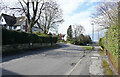
Farley Road
The junction is between Farley Road and St. Clare's Close, which drops steeply down the hill towards St. Albans Road. though it doesn't actually make a connection with it.
Image: © Malcolm Neal
Taken: 12 Mar 2021
0.02 miles
2
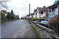
Farley Road
The larger houses on Farley Road look to be very desirable properties. The one potential drawback is that the gardens to the rear are on a north facing slope and so get less sun.
Image: © Malcolm Neal
Taken: 12 Mar 2021
0.05 miles
3
East end of Farley Road, Littleover
Off Burton Road.
Image: © Richard Vince
Taken: 6 Apr 2019
0.05 miles
4

Burton Road
Approaching the brow of the hill the road drops down several times as it leads to the city centre. The houses at this end of the road are large and well set back from the traffic.
Image: © Malcolm Neal
Taken: 12 Mar 2021
0.05 miles
5
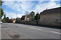
Burton Road
The sunlit wall next to the lamp standard is the entrance to the pretentiously named Atwal Manor. This is a very large house set a little way back from the road.
Image: © Malcolm Neal
Taken: 12 Mar 2021
0.06 miles
6
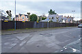
Farley Road
The fence surrounds the Rykneld Crown Green Bowls Club. Parking is obviously a problem from the several yellow 'No Parking' signs on the fence.
Image: © Malcolm Neal
Taken: 13 Mar 2021
0.06 miles
7

Burton Road
Looking along Burton Road (A5250) towards its junction with Manor Road (the Ring Road - A5111).
Image: © David Dixon
Taken: 18 Apr 2010
0.06 miles
8
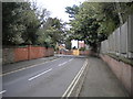
West end of Whitaker Road, Littleover
Off Burton Road.
Image: © Richard Vince
Taken: 6 Apr 2019
0.07 miles
9
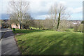
Rykneld Recreation Ground
The recreation ground drops steeply down towards Bishop Lonsdale College School. It is a pleasant open area for children to run free and for anyone to have a good walk.
Image: © Malcolm Neal
Taken: 12 Mar 2021
0.08 miles
10
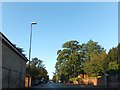
Burton Road close to the Derby Ring Road
A view from almost the same place as Image, but with wet roads and more foliage on the trees. Burton Road has many mature trees along its length in the suburbs of Derby
Image: © David Smith
Taken: 17 Oct 2012
0.09 miles