
IMAGES TAKEN NEAR TO
Golf Close, DERBY, DE23 4TL
Introduction
This page details the photographs taken nearby to Golf Close, DE23 4TL by members of the Geograph project.
The Geograph project started in 2005 with the aim of publishing, organising and preserving representative images for every square kilometre of Great Britain, Ireland and the Isle of Man.

There are currently over 7.5m images from over14,400 individuals and you can help contribute to the project by visiting https://www.geograph.org.uk
Image Map
Images are licensed for reuse under creativecommons.org/licenses/by-sa/2.0
Notes
- Clicking on the map will re-center to the selected point.
- The higher the marker number, the further away the image location is from the centre of the postcode.
Image Listing (41 Images Found)
Images are licensed for reuse under creativecommons.org/licenses/by-sa/2.0
Image
Details
Distance
1

Keats Avenue
Keats Avenue is a private road of mainly very large houses with extensive grounds. Being a private road the surface is not particularly good.
Image: © Malcolm Neal
Taken: 20 Dec 2020
0.05 miles
2

Keats Avenue
Keats Avenue is a private road with no access for none residential vehicles. The houses are all substantial and it is a very quiet area.
Image: © Malcolm Neal
Taken: 21 Mar 2021
0.07 miles
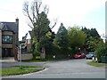
4

Keats Avenue
This is the only undeveloped land on Keats Avenue. I am surprised it has resisted development, but perhaps the owners do not wish a house to be placed on it.
Image: © Malcolm Neal
Taken: 21 Mar 2021
0.09 miles
5
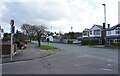
Chain Lane
The road changes its name just behind the photographer and becomes Corden Avenue, however the houses are of a similar type.
Image: © Malcolm Neal
Taken: 25 Feb 2021
0.10 miles
6

Keats Avenue
Keats Avenue with all the trees looking very bare in this winter morning view along the avenue. The road surface in this view is reasonable but suffering from mud and decayed leaves at the edges.
Image: © Malcolm Neal
Taken: 20 Dec 2020
0.11 miles
7

Chain Lane
At this end of Chain Lane we have mainly larger detached houses with large gardens front and back.
Image: © Malcolm Neal
Taken: 25 Feb 2021
0.11 miles
8
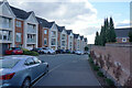
Greenway Drive
Greenway Drive at its upper end is built on the grounds of the Coppice Hotel. This was a listed structure but had two or three fires after it fell out of use and before the land was developed.
Image: © Malcolm Neal
Taken: 25 Feb 2021
0.14 miles
9

Chain Lane
Walking along Chain Lane towards the junction with Burton Road.
Image: © Malcolm Neal
Taken: 25 Feb 2021
0.15 miles
10
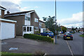
Dean Close
Cars parked on the pavement are a nuisance especially for the visually impaired.
Image: © Malcolm Neal
Taken: 25 Feb 2021
0.15 miles