
IMAGES TAKEN NEAR TO
Maypole Lane, DERBY, DE23 4BQ
Introduction
This page details the photographs taken nearby to Maypole Lane, DE23 4BQ by members of the Geograph project.
The Geograph project started in 2005 with the aim of publishing, organising and preserving representative images for every square kilometre of Great Britain, Ireland and the Isle of Man.

There are currently over 7.5m images from over14,400 individuals and you can help contribute to the project by visiting https://www.geograph.org.uk
Image Map
Images are licensed for reuse under creativecommons.org/licenses/by-sa/2.0
Notes
- Clicking on the map will re-center to the selected point.
- The higher the marker number, the further away the image location is from the centre of the postcode.
Image Listing (65 Images Found)
Images are licensed for reuse under creativecommons.org/licenses/by-sa/2.0
Image
Details
Distance
1
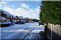
Maypole Lane
This suburban road has even more snow laying on its surface.
Image: © Malcolm Neal
Taken: 25 Jan 2021
0.03 miles
2
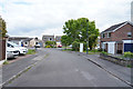
Leslie Close
The roads in this estate twist and turn so it is not always clear which road, street, lane or close you are in until you find a street name sign.
Image: © Malcolm Neal
Taken: 2 May 2020
0.04 miles
3
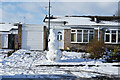
A tall snowman
The snowman is about eight foot tall which is approximately 2.6 metres. Quite the tallest snowman I have seen for many years.
Image: © Malcolm Neal
Taken: 25 Jan 2021
0.06 miles
4
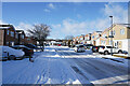
Dennis Close
This road has clearly not been gritted and has also had only a little traffic to break up the heavy fall of snow that we had yesterday.
Image: © Malcolm Neal
Taken: 25 Jan 2021
0.07 miles
5
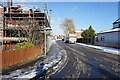
Haven Baulk Avenue
Haven Baulk Avenue joins Haven Baulk Lane at this point and then turns 90 degrees to run parallel with the lane.
Image: © Malcolm Neal
Taken: 25 Jan 2021
0.07 miles
6
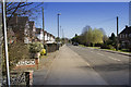
Havenbaulk Lane
This lane connects the suburbs of Mickleover and Littleover. The latter has expanded into a further suburb Heatherton. This gradual and not so gradual expansion is happening all around Derby.
Image: © Malcolm Neal
Taken: 15 Mar 2017
0.07 miles
7
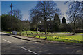
Havenbaulk Lane
This image shows a small green space between the houses. It leads to a further field on the edge of Derby. The further field is quite likely to be developed into housing in the future.
Image: © Malcolm Neal
Taken: 15 Mar 2017
0.08 miles
8
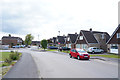
Matthew Way
The road off to the left is the one that leads to Littleover School and the footpath we take to go back home.
Image: © Malcolm Neal
Taken: 2 May 2020
0.08 miles
9
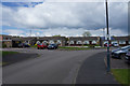
Leslie Close
Leslie Close curves away to the right whilst Allan Avenue is the road off to the left.
Image: © Malcolm Neal
Taken: 2 May 2020
0.09 miles
10

Looking back along the footpath
Almost at Maypole Lane and looking back along the garden fences of some of the houses.
Image: © Malcolm Neal
Taken: 2 May 2020
0.09 miles