
IMAGES TAKEN NEAR TO
Pastures Hill, DERBY, DE23 4AZ
Introduction
This page details the photographs taken nearby to Pastures Hill, DE23 4AZ by members of the Geograph project.
The Geograph project started in 2005 with the aim of publishing, organising and preserving representative images for every square kilometre of Great Britain, Ireland and the Isle of Man.

There are currently over 7.5m images from over14,400 individuals and you can help contribute to the project by visiting https://www.geograph.org.uk
Image Map
Images are licensed for reuse under creativecommons.org/licenses/by-sa/2.0
Notes
- Clicking on the map will re-center to the selected point.
- The higher the marker number, the further away the image location is from the centre of the postcode.
Image Listing (33 Images Found)
Images are licensed for reuse under creativecommons.org/licenses/by-sa/2.0
Image
Details
Distance
1
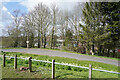
Littleover School entrance
This is the curving transport entrance to Littleover School. Pedestrian access from this side is a little further up the hill.
Image: © Malcolm Neal
Taken: 25 Mar 2021
0.03 miles
2
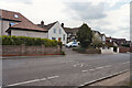
Pastures Hill
Just above Littleover School on Pastures Hill, you can see the on road school sign.
Image: © Malcolm Neal
Taken: 25 Mar 2021
0.04 miles
3
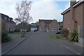
Foxbrook Close
These houses are built in a different coloured brick when makes a change that the whole estate is not the same.
Image: © Malcolm Neal
Taken: 2 Mar 2021
0.07 miles
4

Badgerdale Way
Cars parked outside the flats at the end of Badgerdale Way.
Image: © Malcolm Neal
Taken: 2 Mar 2021
0.10 miles
5
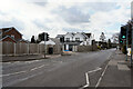
Pastures Hill
The white house across the road looks as though it has been freshly painted.
Image: © Malcolm Neal
Taken: 25 Mar 2021
0.10 miles
6
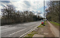
Pastures Hill
Pastures Hill at this point is also called Ryknild Street according to the map viewable on Geograph which allows us to position the camera and image target places.
Image: © Malcolm Neal
Taken: 25 Mar 2021
0.11 miles
7

Pastures Hill, Littleover
This road follows the route of the Roman Rykneld Street and was part of the A38 until a dual carriageway was built to the north in the 1970s
Image: © Ray Folwell
Taken: 4 Apr 2010
0.11 miles
8
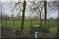
By the Hell Brook
Standing by the Hell Brook with what looks like a flow meter in it. The view is across the playing field of Littleover Secondary School to look at the newer building that is on what used to be the staff car park when our children went to the school.
Image: © Malcolm Neal
Taken: 7 Feb 2021
0.12 miles
9

Badgerdale Way
The concrete block wall outside this building is rather out of place in this area.
Image: © Malcolm Neal
Taken: 2 Mar 2021
0.13 miles
10

Woodcote Way
Looking up the hill towards the end of Woodcote Way.
Image: © Malcolm Neal
Taken: 2 Mar 2021
0.13 miles