
IMAGES TAKEN NEAR TO
Elms Farm Way, DERBY, DE23 3XZ
Introduction
This page details the photographs taken nearby to Elms Farm Way, DE23 3XZ by members of the Geograph project.
The Geograph project started in 2005 with the aim of publishing, organising and preserving representative images for every square kilometre of Great Britain, Ireland and the Isle of Man.

There are currently over 7.5m images from over14,400 individuals and you can help contribute to the project by visiting https://www.geograph.org.uk
Image Map
Images are licensed for reuse under creativecommons.org/licenses/by-sa/2.0
Notes
- Clicking on the map will re-center to the selected point.
- The higher the marker number, the further away the image location is from the centre of the postcode.
Image Listing (15 Images Found)
Images are licensed for reuse under creativecommons.org/licenses/by-sa/2.0
Image
Details
Distance
1
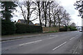
Pastures Hill
The trees on the side of the road do something to reduce the traffic noise for the houses that are visible.
Image: © Malcolm Neal
Taken: 25 Mar 2021
0.07 miles
2
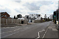
Pastures Hill
The white house across the road looks as though it has been freshly painted.
Image: © Malcolm Neal
Taken: 25 Mar 2021
0.09 miles
3

Pastures Hill
Looking again across Pastures Hill as we walk down the hill towards the secondary school.
Image: © Malcolm Neal
Taken: 25 Mar 2021
0.10 miles
4
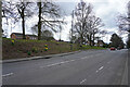
Pastures Hill
Looking at another bank with a few spring time Daffodils in bloom.
Image: © Malcolm Neal
Taken: 25 Mar 2021
0.12 miles
5
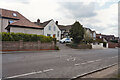
Pastures Hill
Just above Littleover School on Pastures Hill, you can see the on road school sign.
Image: © Malcolm Neal
Taken: 25 Mar 2021
0.14 miles
6
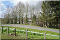
Littleover School entrance
This is the curving transport entrance to Littleover School. Pedestrian access from this side is a little further up the hill.
Image: © Malcolm Neal
Taken: 25 Mar 2021
0.17 miles
7
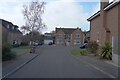
Foxbrook Close
These houses are built in a different coloured brick when makes a change that the whole estate is not the same.
Image: © Malcolm Neal
Taken: 2 Mar 2021
0.18 miles
8
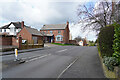
Coppicewood Drive
Coppicewood Drive runs over the brow of the hill down towards the land that is where Mickleover Golf Club has its course.
Image: © Malcolm Neal
Taken: 25 Mar 2021
0.19 miles
9
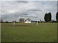
Littleover: King George V Playing Field
Looking much as it did forty years ago when I played for Littleover Cricket Club in the Notts & Derby Border League (though there was not much sign of a square on this March morning).
Image: © John Sutton
Taken: 12 Mar 2013
0.19 miles
10
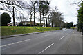
Pastures Hill
Looking across Pastures Hill to the bank that has quite a number of Daffodil flowers, showing spring has sprung!
Image: © Malcolm Neal
Taken: 25 Mar 2021
0.20 miles