
IMAGES TAKEN NEAR TO
Blagreaves Lane, DERBY, DE23 1PW
Introduction
This page details the photographs taken nearby to Blagreaves Lane, DE23 1PW by members of the Geograph project.
The Geograph project started in 2005 with the aim of publishing, organising and preserving representative images for every square kilometre of Great Britain, Ireland and the Isle of Man.

There are currently over 7.5m images from over14,400 individuals and you can help contribute to the project by visiting https://www.geograph.org.uk
Image Map
Images are licensed for reuse under creativecommons.org/licenses/by-sa/2.0
Notes
- Clicking on the map will re-center to the selected point.
- The higher the marker number, the further away the image location is from the centre of the postcode.
Image Listing (10 Images Found)
Images are licensed for reuse under creativecommons.org/licenses/by-sa/2.0
Image
Details
Distance
1
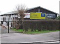
St Andrew's Church, Littleover
This small wooden Anglican church is also home to St Andrew's Pre-school. It is one of two churches on Blagreaves Lane.
Image: © Nikki Mahadevan
Taken: 13 Feb 2007
0.11 miles
2
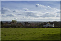
Across the fields
A small area of green field within the suburb of newer Littleover.
Image: © Malcolm Neal
Taken: 14 Mar 2017
0.14 miles
3
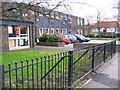
Blagreaves Lane Library, Littleover
Image: © Nikki Mahadevan
Taken: 13 Feb 2007
0.22 miles
4
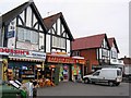
Shops at Sunny Hill
Shops near the junction with Stenson Road, in this southern surburb of Derby.
Image: © Nikki Mahadevan
Taken: 13 Feb 2007
0.23 miles
5
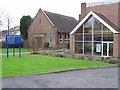
Newmount Methodist Church, Littleover
One of two churches on Blagreaves Lane. The other is a small wooden Anglican church.
Image: © Nikki Mahadevan
Taken: 13 Feb 2007
0.23 miles
6
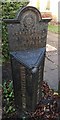
Old Boundary Marker
Parish Boundary Marker by number 396 Stenson Road, Sunnyhill. DERBY parish. PARISH OF LITTLEOVER cast on left face, PARISH OF DERBY cast on right face, APRIL 1ST 1932 cast on beveled top face and a coat of arms and BOUNDARY OF / THE BOROUGH / OF DERBY cast on the head face.
Milestone Society National ID: DE_DER01pb
Image: © S Knight
Taken: 19 Dec 2018
0.23 miles
7
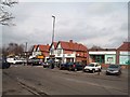
Sunny Hill in Derby
A busy hub of shops on Blagreaves Lane close to its junction with Stenson Road. The flat-roofed building on the left is the local library.
Image: © Jonathan Clitheroe
Taken: 8 Mar 2014
0.24 miles
8
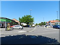
Blagreaves Lane, from Stenson Road
Shops at a road junction, in Sunny Hill, a suburb of Derby.
Image: © Peter Barr
Taken: 25 May 2012
0.24 miles
9
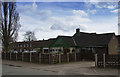
The Oaklands
This public house was originally called the Panther and is found in the new part of Littleover, though the houses and the public house are now probably more than 50 years old.
Image: © Malcolm Neal
Taken: 14 Mar 2017
0.24 miles
10
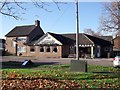
The Oaklands
"The Oaklands" opened in the 1960s and was originally called "The Panther".
Image: © Ian Calderwood
Taken: 23 Nov 2012
0.25 miles