
IMAGES TAKEN NEAR TO
Highgate Green, DERBY, DE22 4GG
Introduction
This page details the photographs taken nearby to Highgate Green, DE22 4GG by members of the Geograph project.
The Geograph project started in 2005 with the aim of publishing, organising and preserving representative images for every square kilometre of Great Britain, Ireland and the Isle of Man.

There are currently over 7.5m images from over14,400 individuals and you can help contribute to the project by visiting https://www.geograph.org.uk
Image Map
Images are licensed for reuse under creativecommons.org/licenses/by-sa/2.0
Notes
- Clicking on the map will re-center to the selected point.
- The higher the marker number, the further away the image location is from the centre of the postcode.
Image Listing (10 Images Found)
Images are licensed for reuse under creativecommons.org/licenses/by-sa/2.0
Image
Details
Distance
1
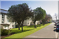
Brackensdale Avenue
The flats on Brackensdale Avenue are seen here.
Image: © Malcolm Neal
Taken: 8 Apr 2017
0.06 miles
2
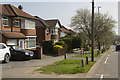
Brackensdale Avenue
This is the other end of Brackensdale Avenue. Semi-detached houses but much closer to Derby Ring Road.
Image: © Malcolm Neal
Taken: 8 Apr 2017
0.18 miles
3
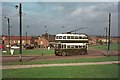
British Trolleybuses - Derby
In the post-war years, Derby extended its trolleybus network into the new Mackworth Estate to the northwest of the City Centre. The route terminated here at Morden Green. There has been some tree planting since this picture was taken but otherwise little has changed.
For a slide show of British Trolleybuses in the late 60s http://www.geograph.org.uk/search.php?i=1773236&displayclass=slide
Image: © Alan Murray-Rust
Taken: 15 Oct 1966
0.19 miles
4
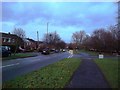
Prince Charles Avenue in Mackworth
Pictured at its junction with Collingham Gardens.
Image: © Jonathan Clitheroe
Taken: 20 Dec 2014
0.20 miles
5
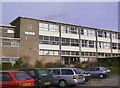
A Block Mackworth College
The former A Block at Mackworth FE College. When the college merged with Wilmorton College to become Derby College this site (one of two) of Mackworth College was not needed and sold for housing which now occupies the site.
Image: © Malcolm Neal
Taken: 3 Apr 1998
0.22 miles
6
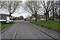
Sloane Road
Now at the end of Birdcage Walk we come to Sloane Road and other streets of semi-detached houses.
Image: © Malcolm Neal
Taken: 8 Apr 2021
0.23 miles
7
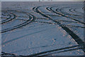
Tracks in the snow
Tracks in the snow in a carpark that no longer exists. The Mackworth College that used to be here has been redeveloped for housing since the picture was taken in 2004.
Image: © Malcolm Neal
Taken: 28 Jan 2004
0.24 miles
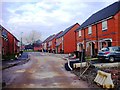
9
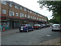
Shops with flats over
Off Prince Charles Avenue, Mackworth.
Includes the Post Office.
Image: © JThomas
Taken: 20 Jun 2015
0.24 miles
10
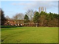
Recreation ground
Previously allotment gardens until the current A38 was built in the 1970s.
Image: © Ian Calderwood
Taken: 22 Dec 2017
0.25 miles