
IMAGES TAKEN NEAR TO
Faire Street, DERBY, DE22 3WB
Introduction
This page details the photographs taken nearby to Faire Street, DE22 3WB by members of the Geograph project.
The Geograph project started in 2005 with the aim of publishing, organising and preserving representative images for every square kilometre of Great Britain, Ireland and the Isle of Man.

There are currently over 7.5m images from over14,400 individuals and you can help contribute to the project by visiting https://www.geograph.org.uk
Image Map
Images are licensed for reuse under creativecommons.org/licenses/by-sa/2.0
Notes
- Clicking on the map will re-center to the selected point.
- The higher the marker number, the further away the image location is from the centre of the postcode.
Image Listing (58 Images Found)
Images are licensed for reuse under creativecommons.org/licenses/by-sa/2.0
Image
Details
Distance
1
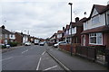
Bramfield Avenue
Yet further along Bramfield Avenue but the view shows the houses are still semi-detached with the front garden used by many for a car parking area.
Image: © Malcolm Neal
Taken: 11 Mar 2020
0.03 miles
2
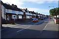
Bramfield Avenue
This is where Boyer Street becomes Bramfield Avenue. It is not entirely clear when walking along where the change in street name occurs unless you look at the house numbers!
Image: © Malcolm Neal
Taken: 12 Mar 2020
0.04 miles
3
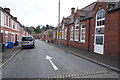
Percy Street
Showing the Firs Estate Primary School at the weekend in total quiet as all the pupils are at home or else where.
Image: © Malcolm Neal
Taken: 14 Mar 2020
0.05 miles
4
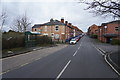
Dean Street
This view is looking up Dean Street near where it joins Bramfield Avenue. Dean Street is mainly older terraced housing with also a former factory further along the road on the right hand side.
Image: © Malcolm Neal
Taken: 11 Mar 2020
0.06 miles
5
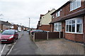
Bramfield Avenue
As you can see this part of Bramfield Avenue has rather older semi-detached houses and many have used the front gardens for off street parking.
Image: © Malcolm Neal
Taken: 11 Mar 2020
0.06 miles
6
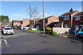
Leman Street
Newer semi-detached houses built after redevelopment of part of this area. They are in the midst of rather older terraced houses.
Image: © Malcolm Neal
Taken: 12 Mar 2020
0.06 miles
7
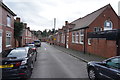
Percy Street
Percy Street has a lot of houses and also the Firs Estate Primary School that you can just see on the right side of the image.
Image: © Malcolm Neal
Taken: 11 Mar 2020
0.08 miles
8
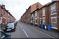
Dean Street
Having walked further along Dean Street this image shows the former factory site mentioned in the previous submission Image
Image: © Malcolm Neal
Taken: 11 Mar 2020
0.08 miles
9
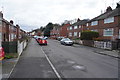
Bramfield Avenue
This view shows a fairly new short terrace with older semi-detached houses around it. The terrace is built on the former home of a friend who had an observatory in the garden, but sadly that is no longer present.
Image: © Malcolm Neal
Taken: 11 Mar 2020
0.08 miles
10
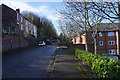
Appleby Court
To the right is the new care homes of Appleby Court, to the left older houses that back up to Burton Road which is much higher. In winter these houses see very little sun as the slope is north facing.
Image: © Malcolm Neal
Taken: 12 Mar 2020
0.11 miles