IMAGES TAKEN NEAR TO
Woods Lane, DERBY, DE22 3UE
Introduction
This page details the photographs taken nearby to Woods Lane, DE22 3UE by members of the Geograph project.
The Geograph project started in 2005 with the aim of publishing, organising and preserving representative images for every square kilometre of Great Britain, Ireland and the Isle of Man.

There are currently over 7.5m images from over14,400 individuals and you can help contribute to the project by visiting https://www.geograph.org.uk
Image Map
Images are licensed for reuse under creativecommons.org/licenses/by-sa/2.0
Notes
- Clicking on the map will re-center to the selected point.
- The higher the marker number, the further away the image location is from the centre of the postcode.
Image Listing (88 Images Found)
Images are licensed for reuse under creativecommons.org/licenses/by-sa/2.0
Image
Details
Distance
1
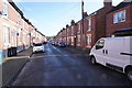
Woods Lane
Now back amongst the older terraced houses, though the newer semis are not far behind and to the left of the camera position.
Image: © Malcolm Neal
Taken: 12 Mar 2020
0.02 miles
2
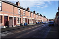
Woods Lane
It is obvious why these quite smart terraced houses have not been redeveloped as they all look very well cared for.
Image: © Malcolm Neal
Taken: 12 Mar 2020
0.04 miles
3
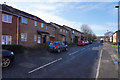
Boyer Street
This end of Boyer Street has been completely redeveloped and it was carried out many years ago.
Image: © Malcolm Neal
Taken: 12 Mar 2020
0.06 miles
4
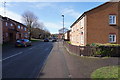
Boyer Street
This is another view along the redeveloped Boyer Street.
Image: © Malcolm Neal
Taken: 12 Mar 2020
0.06 miles
5
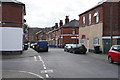
Farm Street
Farm Street is part of an area of Derby that has not been redeveloped which means the houses were in a better state than those in the Stockbrook Area which has been completely redeveloped.
Image: © Malcolm Neal
Taken: 11 Mar 2020
0.08 miles
6
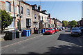
Warner Street
From just below Argyle Street looking along Warner Street towards the city centre.
Argyle Street is reputed to be the steepest street in Derby and connects Warner Street and Burton Road. It is cobbled and only accessible at both ends to pedestrians with the Burton Road end closed off to cars and other motorised traffic.
Image: © Malcolm Neal
Taken: 22 Apr 2020
0.08 miles
7
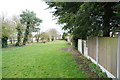
Stockbrook Park
This is the south eastern edge of Stockbrook Park, being separated from the houses to the right by a variety of garden fences.
Image: © Malcolm Neal
Taken: 11 Mar 2020
0.09 miles
8
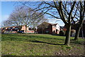
A pleasant grassy area amidst the newer houses
This small open space has been left amongst the newer houses in this redeveloped area. It makes a very pleasant change after the red brick terraces that are nearby.
Image: © Malcolm Neal
Taken: 12 Mar 2020
0.10 miles
9
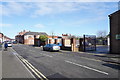
Farm Street
The view looks towards Woods Lane and show the car park behind the Sainsbury's Local store.
Image: © Malcolm Neal
Taken: 12 Mar 2020
0.10 miles