
IMAGES TAKEN NEAR TO
Dunkirk, DERBY, DE22 3QN
Introduction
This page details the photographs taken nearby to Dunkirk, DE22 3QN by members of the Geograph project.
The Geograph project started in 2005 with the aim of publishing, organising and preserving representative images for every square kilometre of Great Britain, Ireland and the Isle of Man.

There are currently over 7.5m images from over14,400 individuals and you can help contribute to the project by visiting https://www.geograph.org.uk
Image Map
Images are licensed for reuse under creativecommons.org/licenses/by-sa/2.0
Notes
- Clicking on the map will re-center to the selected point.
- The higher the marker number, the further away the image location is from the centre of the postcode.
Image Listing (167 Images Found)
Images are licensed for reuse under creativecommons.org/licenses/by-sa/2.0
Image
Details
Distance
1
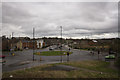
Mercian Way Derby
One of the new roads that completed Derby's Inner Ring Road.
Image: © Malcolm Neal
Taken: 18 Mar 2017
0.03 miles
2
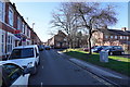
Drewry Lane
The Kensington Tavern is a public house on the corner of Talbot Street and Drewry Lane. Drewry Lane is mainly lined by terraced houses and a series of flats in a repurposed factory.
Image: © Malcolm Neal
Taken: 25 Feb 2020
0.04 miles
4
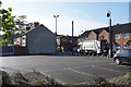
Looking towards Talbot Street
The view across the carpark looks at The Kensington Tavern which is at the end of Talbot Street. The tavern is one of Derby's smaller pubs.
Image: © Malcolm Neal
Taken: 8 Oct 2019
0.05 miles
6
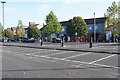
Abbey Street
A view across the car park to some of the businesses at the lower end of Abbey Street, reputed to be the longest straight street in Derby
Image: © Malcolm Neal
Taken: 8 Oct 2019
0.07 miles
7
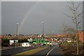
Rainbow over a new road
The new section of the A601 is nearly ready to open. As can be seen cyclists are already using the new cycle path along side.
Image: © David Lally
Taken: 25 Jan 2011
0.08 miles
8
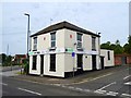
Anvil Press
Formerly the Vine Inn, built by Altons Brewery in 1862. It closed in 1991, after it was caught hosting some legally-dubious "adult entertainment".
Image: © Ian Calderwood
Taken: 23 Jun 2018
0.09 miles
9
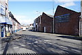
Monk Street
This is the junction of Monk Street with Werburgh Street. The large buildings to the right are old factories which still house busineses and to the left are various shops and private houses.
Image: © Malcolm Neal
Taken: 25 Feb 2020
0.09 miles
10
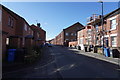
A repurposed factory on Drewry Lane
The large building on the centre right with its end in shadow is an old factory that was converted into flats a few years ago. The Factory was James Smith and Co. who manufactured clothing.
Image: © Malcolm Neal
Taken: 25 Feb 2020
0.09 miles