IMAGES TAKEN NEAR TO
Monk Street, DERBY, DE22 3QE

Introduction

This page details the photographs taken nearby to Monk Street, DE22 3QE by members of the Geograph project.

The Geograph project started in 2005 with the aim of publishing, organising and preserving representative images for every square kilometre of Great Britain, Ireland and the Isle of Man.

There are currently over 7.5m images from over14,400 individuals and you can help contribute to the project by visiting https://www.geograph.org.uk

Image Map


Images are licensed for reuse under creativecommons.org/licenses/by-sa/2.0
Notes
  • Clicking on the map will re-center to the selected point.
  • The higher the marker number, the further away the image location is from the centre of the postcode.

Image Listing (106 Images Found)

Images are licensed for reuse under creativecommons.org/licenses/by-sa/2.0
  • ...
Image
Details
Distance
1
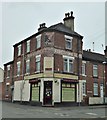
Monk Street
This is the junction of Monk Street with Werburgh Street. The large buildings to the right are old factories which still house busineses and to the left are various shops and private houses.
Image: © Malcolm Neal Taken: 25 Feb 2020
0.01 miles
2
Woods Lane Stores
With well preserved painted signs.
Image: © David Lally Taken: 15 Apr 2018
0.05 miles
3
Abbey Street Derby
Looking up Abbey Street towards a very distant Burton Road. Anvil Press has been in the building for many years.
Image: © Malcolm Neal Taken: 25 Feb 2020
0.05 miles
4
Anvil Press
Formerly the Vine Inn, built by Altons Brewery in 1862. It closed in 1991, after it was caught hosting some legally-dubious "adult entertainment".
Image: © Ian Calderwood Taken: 23 Jun 2018
0.06 miles
5
Abbey Street Derby
Looking north along Abbey Street at its junction with Stockbrook Street.
Image: © Malcolm Neal Taken: 25 Feb 2020
0.06 miles
6
Stockbrook Street
A drab day with light rain at the start of Stockbrook Street with some fairly new houses on the left side of the street.
Image: © Malcolm Neal Taken: 3 Mar 2020
0.07 miles
7
Werburgh Street Derby
Further along Werburgh Street, towards the city centre there are fewer parked cars, possibly because it is mid afternoon on a working day. The railings to the right mark the boundary of Becket Primary School.
Image: © Malcolm Neal Taken: 25 Feb 2020
0.07 miles
8
Rainbow over a new road
The new section of the A601 is nearly ready to open. As can be seen cyclists are already using the new cycle path along side.
Image: © David Lally Taken: 25 Jan 2011
0.08 miles
9
Mercian Way
Mercian Way was one of the final parts of the Derby Inner Ring Road to be constructed.
Image: © Malcolm Neal Taken: 25 Feb 2020
0.08 miles
10
King Alfred Street
King Alfred Street is a street with terraced housing on both sides, with no possible off street parking.
Image: © Malcolm Neal Taken: 25 Feb 2020
0.09 miles
  • ...