
IMAGES TAKEN NEAR TO
Radbourne Street, DERBY, DE22 3HB
Introduction
This page details the photographs taken nearby to Radbourne Street, DE22 3HB by members of the Geograph project.
The Geograph project started in 2005 with the aim of publishing, organising and preserving representative images for every square kilometre of Great Britain, Ireland and the Isle of Man.

There are currently over 7.5m images from over14,400 individuals and you can help contribute to the project by visiting https://www.geograph.org.uk
Image Map
Images are licensed for reuse under creativecommons.org/licenses/by-sa/2.0
Notes
- Clicking on the map will re-center to the selected point.
- The higher the marker number, the further away the image location is from the centre of the postcode.
Image Listing (59 Images Found)
Images are licensed for reuse under creativecommons.org/licenses/by-sa/2.0
Image
Details
Distance
1
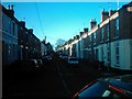
Radbourne Street from Langley Street, Derby
Looking up Radbourne Street from its junction with Langley Street.
Image: © Eamon Curry
Taken: 23 Oct 2007
0.01 miles
2
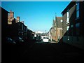
Langley Street from Stanley Street, Derby
Looking down Langley Street from its junction with Stanley Street. Note the University of Derby's main buildings on Kedleston Road in the distance.
Image: © Eamon Curry
Taken: 23 Oct 2007
0.05 miles
4
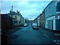
Peel Street from Surrey Street (R), Derby
Looking up Peel Street with Cecil Street to its left and Surrey Street to its right with Richardson Street right behind me.
Image: © Eamon Curry
Taken: 19 Oct 2007
0.08 miles
5
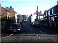
Cobden Street, Derby
Looking up Cobden Street from its junction with Stanley Street in the New Zealand area of Derby.
Image: © Eamon Curry
Taken: 29 Mar 2008
0.09 miles
6
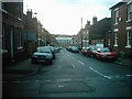
Howe Street from Stanley Street, Derby
Looking down Howe Street from its junction with Stanley Street.
Image: © Eamon Curry
Taken: 19 Oct 2007
0.10 miles
7
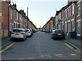
The way to Berwick-upon-Tweed, via New Zealand
Stanley Street, Derby, near the start of Sustrans National Cycle Route 68, at this point sharing with Route 54. Route 68 finishes at Berwick, and this district of terraced housing takes its name of New Zealand from the farm which it displaced.
Image: © Alan Murray-Rust
Taken: 5 Nov 2017
0.10 miles
8
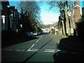
Bass Street from Radbourne Street, Derby
Looking down Bass Street from its junction with Radbourne Street. Just out of shot to the right is Saint Barnabas Church.
Image: © Eamon Curry
Taken: 23 Oct 2007
0.12 miles
9
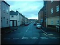
Manchester Street from Surrey Street, Derby
Looking down Manchester Street from its junction with Surrey Street.
Image: © Eamon Curry
Taken: 19 Oct 2007
0.12 miles
10

Stanley Street from Campion Street, Derby
Looking up Stanley Street from its junction with Campion Street.
Image: © Eamon Curry
Taken: 22 Oct 2007
0.12 miles