
IMAGES TAKEN NEAR TO
Greenfinch Close, DERBY, DE21 7TG
Introduction
This page details the photographs taken nearby to Greenfinch Close, DE21 7TG by members of the Geograph project.
The Geograph project started in 2005 with the aim of publishing, organising and preserving representative images for every square kilometre of Great Britain, Ireland and the Isle of Man.

There are currently over 7.5m images from over14,400 individuals and you can help contribute to the project by visiting https://www.geograph.org.uk
Image Map
Images are licensed for reuse under creativecommons.org/licenses/by-sa/2.0
Notes
- Clicking on the map will re-center to the selected point.
- The higher the marker number, the further away the image location is from the centre of the postcode.
Image Listing (13 Images Found)
Images are licensed for reuse under creativecommons.org/licenses/by-sa/2.0
Image
Details
Distance
1
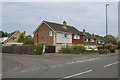
Fellside a cul-de-sac
Off Sancroft Road, Fellside is a short cul-de-sac in Spondon.
Image: © Malcolm Neal
Taken: 6 Jul 2017
0.11 miles
2
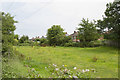
Rough land by Sancroft Road
I was surprised to find this rough land in amongst the houses of Sancroft Road in Spondon. Surprised because I would have thought some developer would have put a number of houses onto it.
Image: © Malcolm Neal
Taken: 6 Jul 2017
0.12 miles

4

South end of Hazel Drive, Spondon
Off Windsor Drive.
Image: © Richard Vince
Taken: 19 Apr 2019
0.17 miles
5
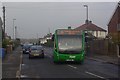
The Spondon Flyer
'Come fly with me to Derby'. The 'Spondon Flyer' may sound grand but is in reality a suburban bus service operated by TrentBarton and it is seen here on Huntley Avenue. The red spot indicates the exact route variant followed by this bus on a grey Sunday morning.
Image: © Stephen McKay
Taken: 13 Nov 2011
0.17 miles
6
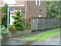
Footpath No.22 to Locko Road
This was the only sign that I saw in the area that made specific reference to a footpath number; no obvious reason why this one should be singled out. It also gives access to a patch of allotments.
Image: © Alan Murray-Rust
Taken: 7 Sep 2008
0.18 miles
7
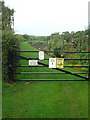
Entrance to allotments
Off footpath number 22 at the back of Sancroft Avenue.
Image: © Alan Murray-Rust
Taken: 7 Sep 2008
0.18 miles
8
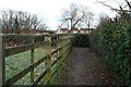
Footpath behind Sancroft Avenue
The footpath to Locko Road runs parallel to the avenue for a short stretch behind the gardens before heading off to the north.
Image: © David Lally
Taken: 1 Jan 2010
0.19 miles
9
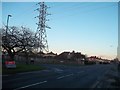
Dale Road in Spondon
Seen here at its junction with Sancroft Road.
Image: © Jonathan Clitheroe
Taken: 11 Jan 2014
0.20 miles
10

Wood Road, Spondon
The end of Wood Road, a cul-de-sac leading off Dale Road.
Image: © Stephen McKay
Taken: 13 Nov 2011
0.22 miles