
IMAGES TAKEN NEAR TO
Treveris Close, DERBY, DE21 7NX
Introduction
This page details the photographs taken nearby to Treveris Close, DE21 7NX by members of the Geograph project.
The Geograph project started in 2005 with the aim of publishing, organising and preserving representative images for every square kilometre of Great Britain, Ireland and the Isle of Man.

There are currently over 7.5m images from over14,400 individuals and you can help contribute to the project by visiting https://www.geograph.org.uk
Image Map
Images are licensed for reuse under creativecommons.org/licenses/by-sa/2.0
Notes
- Clicking on the map will re-center to the selected point.
- The higher the marker number, the further away the image location is from the centre of the postcode.
Image Listing (7 Images Found)
Images are licensed for reuse under creativecommons.org/licenses/by-sa/2.0
Image
Details
Distance
1
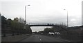
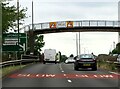
Footbridge over A52 Brain Clough Way
Image: © Anthony Parkes
Taken: 31 Oct 2013
0.10 miles

4
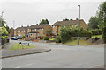
Stoney Lane
Stoney lane at the junction with Sandringham Drive, Spondon. Stoney Lane leads to the A52 - Brian Clough Way that connects Derby with Nottingham.
Image: © Malcolm Neal
Taken: 6 Jul 2017
0.12 miles
5
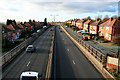
The A52 through Spondon
Now called the Brian Clough Way, it can hardly be said to by-pass Spondon, cutting as it does though the centre of this housing estate.
Image: © David Lally
Taken: 23 Nov 2010
0.15 miles
6
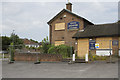
The Yarn Spinner
This public house is obviously closed, perhaps not enough yarns were spun within it to keep it open. It is a sign of the times the number of public houses that are shutting up shop, even in a densely populated suburb such as this.
Image: © Malcolm Neal
Taken: 6 Jul 2017
0.15 miles
7
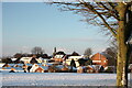
Recreation Ground, South Avenue, Spondon
A view from Gravel Pit Lane across the recreation ground towards St Werburgh's Church
Image: © Francis Dolman
Taken: 27 Dec 2014
0.23 miles