
IMAGES TAKEN NEAR TO
Nottingham Road, DERBY, DE21 7NH
Introduction
This page details the photographs taken nearby to Nottingham Road, DE21 7NH by members of the Geograph project.
The Geograph project started in 2005 with the aim of publishing, organising and preserving representative images for every square kilometre of Great Britain, Ireland and the Isle of Man.

There are currently over 7.5m images from over14,400 individuals and you can help contribute to the project by visiting https://www.geograph.org.uk
Image Map
Images are licensed for reuse under creativecommons.org/licenses/by-sa/2.0
Notes
- Clicking on the map will re-center to the selected point.
- The higher the marker number, the further away the image location is from the centre of the postcode.
Image Listing (66 Images Found)
Images are licensed for reuse under creativecommons.org/licenses/by-sa/2.0
Image
Details
Distance
1
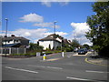
Willowcroft Road, Spondon
Looking rather like a residential road, Willowcroft Road actually forms part of the A6096 from Ilkeston to the A52 in Spondon. Traffic travelling towards Derby reaches the A52 via Nottingham Road, from which this view was taken.
Image: © Richard Vince
Taken: 7 Jul 2012
0.03 miles
2
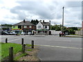
Suburban shops, Nottingham Road
Near the junction with Willowcroft Road.
Image: © Peter Barr
Taken: 23 Jun 2012
0.06 miles
3
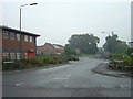
Stoney Gate Road
New industrial estate near Spondon Station
Image: © Alan Murray-Rust
Taken: 31 Aug 2008
0.08 miles
4
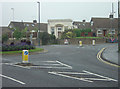
Roundabout at Nottingham Road and Station Road
This nice little building is a former branch bank, and appears to have been converted into a dwelling at some stage.
Image: © Alan Murray-Rust
Taken: 31 Aug 2008
0.09 miles
5

Spondon, Derbys.
Looking across the A6005 (Derby-Nottingham) road from the Station Road side of it and onwards along Lodge Lane. The cream coloured, square-fronted building was built as a National Westminster Bank branch but is now a private dwelling.
Image: © David Hallam-Jones
Taken: 19 Jan 2014
0.09 miles
6

Spondon, Derbys.
This is the A6005 (Derby-Nottingham) road as seen from the corner of Lodge Lane. The cream coloured, square-fronted building was built as a National Westminster Bank branch but is now residential property.
Image: © David Hallam-Jones
Taken: 19 Jan 2014
0.09 miles
7
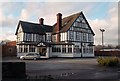
The Moon Public House in Spondon
This pub can be found on Station Road.
Image: © Jonathan Clitheroe
Taken: 1 Feb 2014
0.10 miles
8
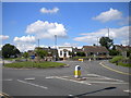
Station Road roundabout, Spondon
The roundabout at which Station Road (out of frame to the left) and Lodge Lane (right) meet Nottingham Road (foreground). The unusually styled house facing the roundabout was formerly a bank; I believe it retained its vault when it was converted to residential use.
Image: © Richard Vince
Taken: 7 Jul 2012
0.10 miles
9
Bench mark, Nottingham Road, Spondon
See http://www.geograph.org.uk/photo/945084 for location. The mark is on the wall right at the left of the picture.
Image: © Alan Murray-Rust
Taken: 26 Apr 2014
0.10 miles
10

Vancouver Avenue, Spondon
Missing the through traffic by not being joined direct to the main Nottingham Road, there is nevertheless a convenient link for pedestrians.
Image: © Alan Murray-Rust
Taken: 31 Aug 2008
0.11 miles