IMAGES TAKEN NEAR TO
Langley Road, DERBY, DE21 7HY
Introduction
This page details the photographs taken nearby to Langley Road, DE21 7HY by members of the Geograph project.
The Geograph project started in 2005 with the aim of publishing, organising and preserving representative images for every square kilometre of Great Britain, Ireland and the Isle of Man.

There are currently over 7.5m images from over14,400 individuals and you can help contribute to the project by visiting https://www.geograph.org.uk
Image Map
Images are licensed for reuse under creativecommons.org/licenses/by-sa/2.0
Notes
- Clicking on the map will re-center to the selected point.
- The higher the marker number, the further away the image location is from the centre of the postcode.
Image Listing (22 Images Found)
Images are licensed for reuse under creativecommons.org/licenses/by-sa/2.0
Image
Details
Distance
1
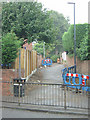
Footpath off Nottingham Road
This path runs up the back of Cambridge Road and clearly marks the boundary between different stages of residential development in Spondon.
Image: © Alan Murray-Rust
Taken: 31 Aug 2008
0.08 miles
2
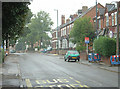
Nottingham Road
The old main road between Nottingham and Derby is still well used although no longer carrying the main traffic which uses the modern dual carriageway slightly to the north.
Image: © Alan Murray-Rust
Taken: 31 Aug 2008
0.09 miles
3
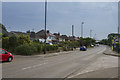
Nottingham Road Spondon
The Nottingham road out of Spondon used to be the main thoroughfare to Nottingham, but it has long since been superseded by the A52 Brian Clough Way.
Image: © Malcolm Neal
Taken: 6 Jul 2017
0.10 miles
4
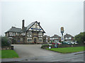
Anglers Arms
Large roadhouse pub on Nottingham Road. It was still sporting the Hardy and Hanson marque although this had already been part of Greene King for 18 months or so.
Image: © Alan Murray-Rust
Taken: 31 Aug 2008
0.10 miles
6
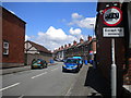
Cambridge Street, Spondon
Seen from the junction with Derby Road.
Image: © Richard Vince
Taken: 7 Jul 2012
0.11 miles
7
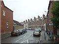
Cambridge Street
Typical terraced housing from around the end of the 19th Century.
Image: © Alan Murray-Rust
Taken: 31 Aug 2008
0.11 miles
8
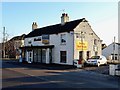
The old Anglers Arms
This was the Anglers Arms before it moved to larger premises across the road, pictured in Image It has had various uses, since closing as a pub, and is currently the Gurkha Paradise restaurant. It has outlived its replacement, which was demolished to make way for housing.
Image: © Ian Calderwood
Taken: 20 Jan 2017
0.11 miles
9
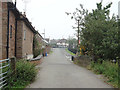
Anglers Lane
View towards Nottingham Road from the former canal bridge
Image: © Alan Murray-Rust
Taken: 31 Aug 2008
0.11 miles