
IMAGES TAKEN NEAR TO
Borrowfield Road, DERBY, DE21 7HG
Introduction
This page details the photographs taken nearby to Borrowfield Road, DE21 7HG by members of the Geograph project.
The Geograph project started in 2005 with the aim of publishing, organising and preserving representative images for every square kilometre of Great Britain, Ireland and the Isle of Man.

There are currently over 7.5m images from over14,400 individuals and you can help contribute to the project by visiting https://www.geograph.org.uk
Image Map
Images are licensed for reuse under creativecommons.org/licenses/by-sa/2.0
Notes
- Clicking on the map will re-center to the selected point.
- The higher the marker number, the further away the image location is from the centre of the postcode.
Image Listing (16 Images Found)
Images are licensed for reuse under creativecommons.org/licenses/by-sa/2.0
Image
Details
Distance
2
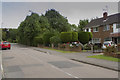
Borrowash Road
Borrowash Road runs from the Old Nottingham Road up to the A52.
Image: © Malcolm Neal
Taken: 6 Jul 2017
0.09 miles
4

Power lines at Spondon
Crossing a tract of unimproved farmland that appears ripe for development. A large industrial site to the east of the picture has already been redeveloped with housing.
Image: © Alan Murray-Rust
Taken: 31 Aug 2008
0.10 miles
6
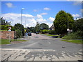
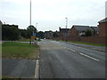
Borrowash Road, Spondon
Despite its name, Borrowash Road is actually a side road that runs perpendicular to Derby Road (from which this picture was taken), which actually leads to Borrowash.
Image: © Richard Vince
Taken: 7 Jul 2012
0.10 miles
7

Old Milepost by the A6005, Nottingham Road
Cast iron post by the A6005, in parish of DERBY (DERBY District), between Spondon and Borrowash, in front of hedge, on North side of road. Derby iron bobbin, erected by the Nottingham Road (from Derby to Risley) turnpike trust in the 19th century.
Inscription reads:-
: NOTT.M / 12 / MILES : : DERBY / 4 / MILES : : HARRISON.DERBY :
Milestone Society National ID: DE_DENT04.
Image: © J Higgins
Taken: 2 Mar 2002
0.11 miles

10

Railway Line near Spondon
Seen here to the east of Spondon Station where it runs up close to a loop in the River Derwent.
Image: © Jonathan Clitheroe
Taken: 1 Feb 2014
0.18 miles