
IMAGES TAKEN NEAR TO
Boston Close, DERBY, DE21 6WB
Introduction
This page details the photographs taken nearby to Boston Close, DE21 6WB by members of the Geograph project.
The Geograph project started in 2005 with the aim of publishing, organising and preserving representative images for every square kilometre of Great Britain, Ireland and the Isle of Man.

There are currently over 7.5m images from over14,400 individuals and you can help contribute to the project by visiting https://www.geograph.org.uk
Image Map
Images are licensed for reuse under creativecommons.org/licenses/by-sa/2.0
Notes
- Clicking on the map will re-center to the selected point.
- The higher the marker number, the further away the image location is from the centre of the postcode.
Image Listing (2 Images Found)
Images are licensed for reuse under creativecommons.org/licenses/by-sa/2.0
Image
Details
Distance
1
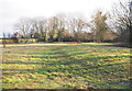
Spondon, Derbys.
The elm trees that characterise the surrounding area once looked down on part of the Coffin Run, a trail that ran from Chaddesden to Spondon. In bygone years when the chapelry of Chaddesden was not authorised to bury their dead, coffins were carried over ('run' over) to St Wegburgh's Church in Spondon for burial. The former Coffin Run is still popular today as a walking route from Chaddesden to Spondon.
Image: © David Hallam-Jones
Taken: 19 Jan 2014
0.23 miles
2
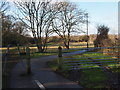
Spondon, Derbys.
An access point into the West Park Meadows Local Nature Reserve from West Road (2 minutes walk away behind the photographer). Following the 'consolidation' of strips of land (worked by local peasants), permitted under one of the late C18th Enclosure Acts this became known as Derby Field, that became the property of the Osborne family of Hill House. West Park School (Park Road) is now situated on the site where Hill House was once stood.
Image: © David Hallam-Jones
Taken: 19 Jan 2014
0.24 miles