
IMAGES TAKEN NEAR TO
Chaddesden Lane, DERBY, DE21 6LQ
Introduction
This page details the photographs taken nearby to Chaddesden Lane, DE21 6LQ by members of the Geograph project.
The Geograph project started in 2005 with the aim of publishing, organising and preserving representative images for every square kilometre of Great Britain, Ireland and the Isle of Man.

There are currently over 7.5m images from over14,400 individuals and you can help contribute to the project by visiting https://www.geograph.org.uk
Image Map
Images are licensed for reuse under creativecommons.org/licenses/by-sa/2.0
Notes
- Clicking on the map will re-center to the selected point.
- The higher the marker number, the further away the image location is from the centre of the postcode.
Image Listing (12 Images Found)
Images are licensed for reuse under creativecommons.org/licenses/by-sa/2.0
Image
Details
Distance
1
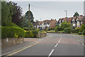
Chaddesden Lane
One of the leafier and more desirable parts of Chaddesden. This is one of the older suburbs on this side of Derby. It used to be next to the countryside but further development has left it quite a way from the edge of Derby.
Image: © Malcolm Neal
Taken: 20 Jun 2017
0.06 miles
2
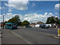
Junction on Nottingham Road, Derby
The junction with Chaddesden Park Road.
Image: © Peter Barr
Taken: 11 Jul 2011
0.07 miles
3
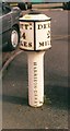
Old Milepost by Nottingham Road, Chaddesden
Cast iron post by the UC road, in parish of DERBY (DERBY District), Chaddesdon, shopping area, in tarmac path between road and parking area for shops, on North side of road. Derby iron bobbin, erected by the Nottingham Road (from Derby to Risley) turnpike trust in the 19th century.
Inscription reads:-
: NOTT.M / 14 / MILES : : DERBY / 2 / MILES : : HARRISON.DERBY :
Milestone Society National ID: DE_DENT02.
Image: © A Rosevear & J Higgins
Taken: 8 Apr 2003
0.09 miles
4
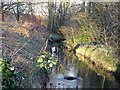
Chaddesden Brook
Photographed in Chaddesden Park in late winter with snowdrops blooming on the banks.
Image: © Ian Calderwood
Taken: 17 Feb 2018
0.14 miles
5
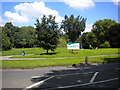
Entrance to Chaddesden Park
Chaddesden Park is largely hidden from view behind buildings, but at this point it extends to meet Nottingham Road. The sign appears to indicate the presence of a diverse array of facilities.
Image: © Richard Vince
Taken: 7 Jul 2012
0.15 miles
6
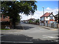
Reginald Road South, Chaddesden
Typical 1930s suburban development, seen from Nottingham Road.
Image: © Richard Vince
Taken: 7 Jul 2012
0.19 miles
7
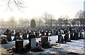
Nottingham Road Cemetery, Derby
A view across the new part of the cemetery on a winter's morning
Image: © Francis Dolman
Taken: 29 Dec 2014
0.22 miles
8
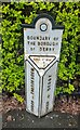
Old Boundary Marker on Nottingham Road, Chaddesden
Parish Boundary Marker against the cemetery wall on the south side of Nottingham Road in Chaddesden, Derby. On the boundary of Chaddesden and Derby parishes, established in 1934. Chaddesden was finally absorbed into Derby in 1968. Derby parish itself was abolished in 1974.
Milestone Society National ID: DE_DER04pb
Image: © N Osmond
Taken: 1 May 2023
0.22 miles
9
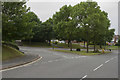
The end of Sunny Grove
This view looks towards the end of Sunny Grove to the Derby / Nottingham Road. It depends where you are on this road for the name to be correct. It is the old main road connecting the two cities but has been superseded by the main A52.
Image: © Malcolm Neal
Taken: 20 Jun 2017
0.23 miles
10
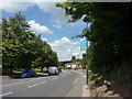
Nottingham Road, Derby
At the junction with Sunny Grove.
Image: © Peter Barr
Taken: 11 Jul 2011
0.23 miles