
IMAGES TAKEN NEAR TO
Moncrieff Crescent, DERBY, DE21 4NR
Introduction
This page details the photographs taken nearby to Moncrieff Crescent, DE21 4NR by members of the Geograph project.
The Geograph project started in 2005 with the aim of publishing, organising and preserving representative images for every square kilometre of Great Britain, Ireland and the Isle of Man.

There are currently over 7.5m images from over14,400 individuals and you can help contribute to the project by visiting https://www.geograph.org.uk
Image Map
Images are licensed for reuse under creativecommons.org/licenses/by-sa/2.0
Notes
- Clicking on the map will re-center to the selected point.
- The higher the marker number, the further away the image location is from the centre of the postcode.
Image Listing (4 Images Found)
Images are licensed for reuse under creativecommons.org/licenses/by-sa/2.0
Image
Details
Distance
1
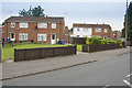
Wood Road
This is a slightly older suburb near Oakwood, or is it part of Chaddesden? The boundary between the two suburbs is not really very clear.
Image: © Malcolm Neal
Taken: 20 Jun 2017
0.15 miles
2

Northern part of Morley Gardens, Oakwood
Image: © Richard Vince
Taken: 19 Apr 2019
0.23 miles
3
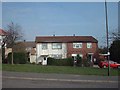
Prefabs Chaddesden
Prefabs in Chaddesden, just meant to last a few years after the Second World War still going strong some 60 years later!
https://web.archive.org/web/20060625160132/http://www.picturesofderby.co.uk/area_chaddesden%20page%203.htm
2015 edit: The houses are not traditional post WWII temporary prefabs; they are BISF (British Iron & Steel Federation) houses which were designed and built immediately after the war to be permanent structures. Many still survive around the country. Here is a https://en.wikipedia.org/wiki/BISF_house to the BISF Wikipedia article.
Image: © mike smith
Taken: Unknown
0.24 miles
4
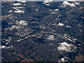
Derby from the air
Looking over Chaddesden towards the city centre from a Glasgow bound flight from Heathrow.
Image: © Thomas Nugent
Taken: 31 Jul 2015
0.24 miles